Information
- Distance: 3 miles
- Grade: Medium
- A GPX route of this walk is available: Download GPX
- Directions to Car Park
- What Three Words
lake.squirts.greeting
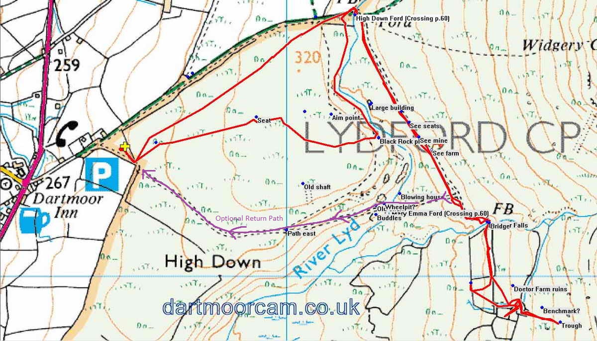
Map
Introduction
This fairly gentle walk has plenty to see along the way. We start with a walk across flattish open moorland to three seats with good views. Then we cross over the River Lyd by footbridge and walk down to the ruined Doe Tor Farmstead. Leaving there, we can return up the river, or detour across the Lyd by stepping stones to the abandoned 19th Century mine, Wheal Mary Emma.
Once parked, head off due East along a worn path for around 350 meters until you see a bench to the left.
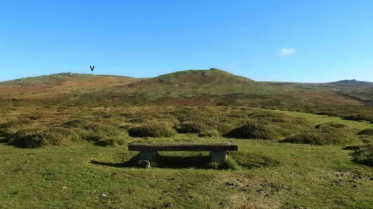
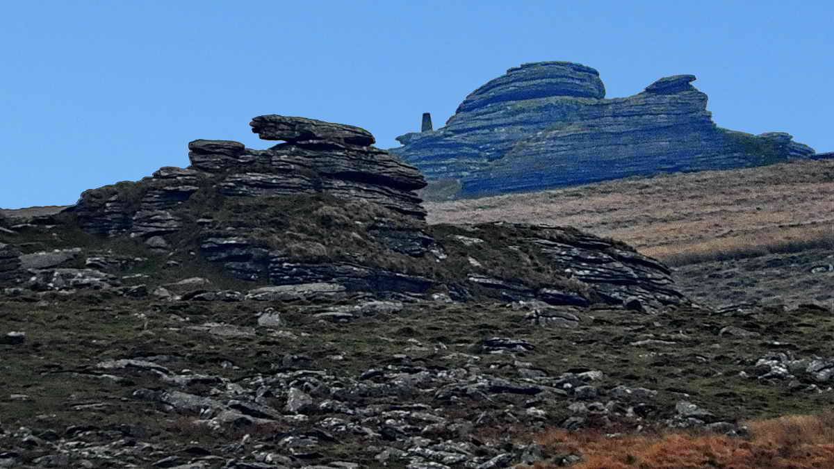
The first seat, with tors behind. These are, left to right:
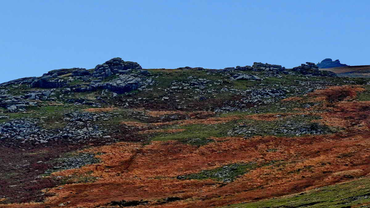
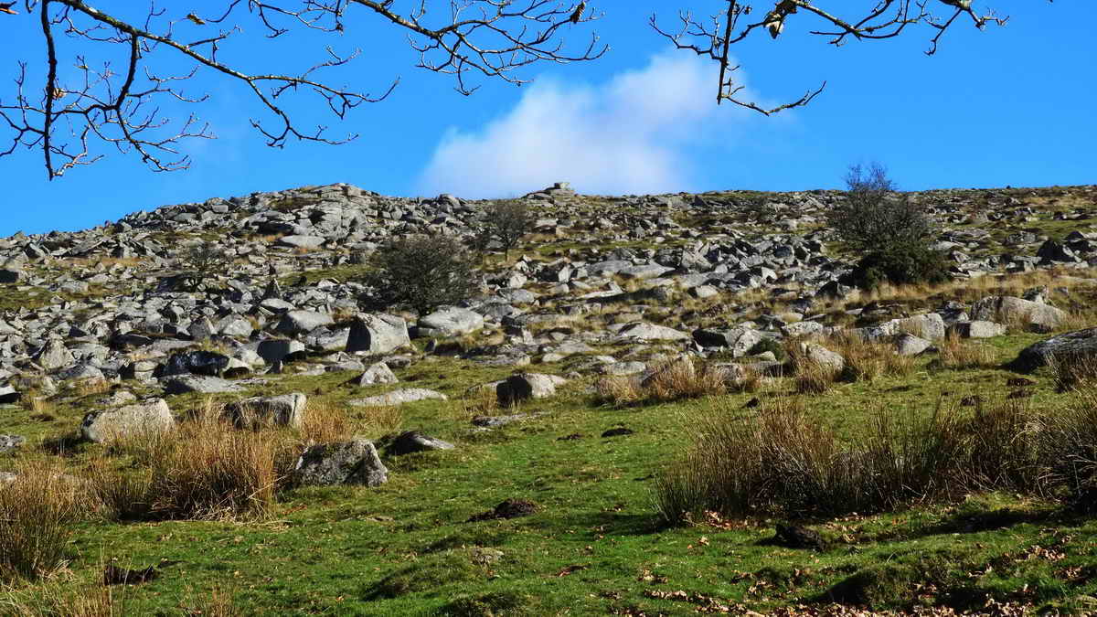
- Arms Tor (SX 541 862, elevation 457 metres / 1499 feet) with a small “pimple” to the right of the summit - marked by the “v” - which is a part of Great Links Tor. (See next picture)
- Brat Tor (SX 539 855, elevation 452 metres /1482 feet) (Also known as Brai, Bra or Bray Tor)
- Sharp Tor (SX 550 848, elevation 519 metres / 1702 feet).
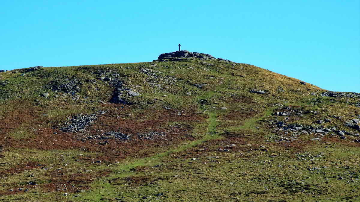
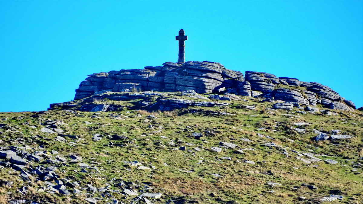
Widgery Cross was erected by the painter William Widgery (1822-1893) to commemorate the Golden Jubilee of Queen Victoria in 1887.
The cross is constructed from 10 courses of granite blocks, capped with a rough slab, reaching 13feet in height.
The words “W. Widgery, Fecit, Jubilee VR” are inscribed on the eastern side of the base stone.
When ready, continue Eastward along the path until you approach the River Lyd
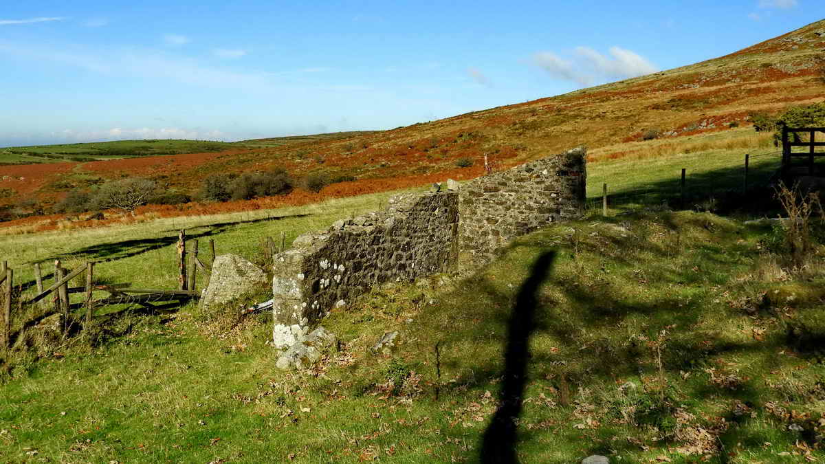
Building or Enclosure
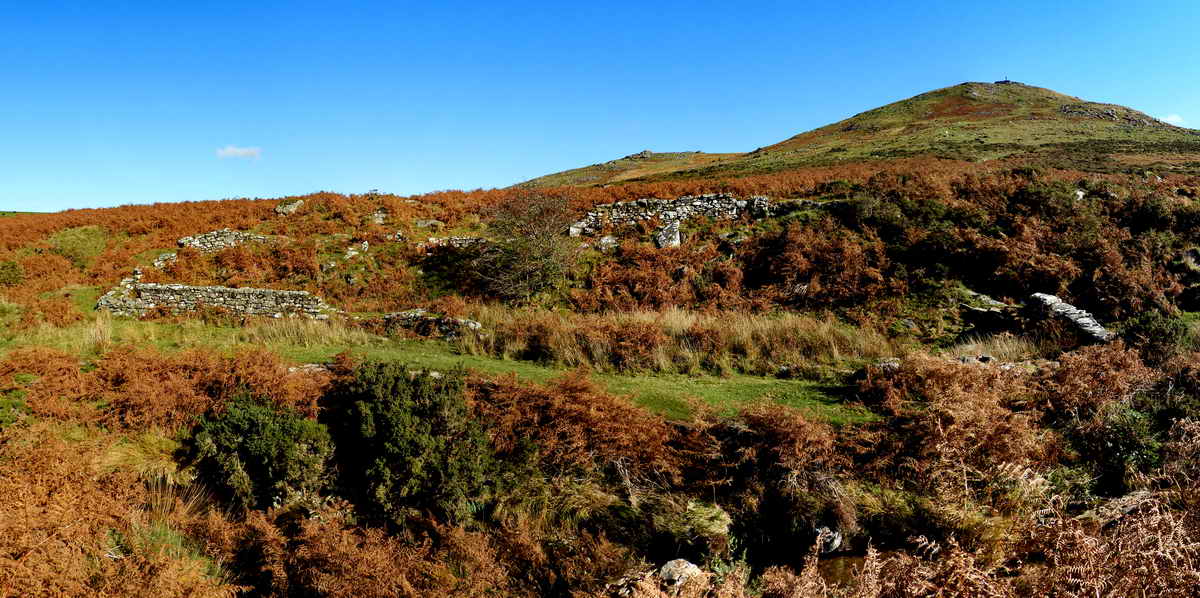
These walls are said to be a large building, although its use is unknown. It might be associated with the Wheal Mary Emma tin mine downstream, but if so, it’s an unusual structure for a mining building.
It does not appear in the tithe map of 1848, nor the OS 25-inch map from 1884, but does show up on the revised 1904 version. The mine was active in the 1860s so the timings are not far out if it was related.
Alternatively, it could be a farming or warren enclosure rather than a building.
Black Rock Seats
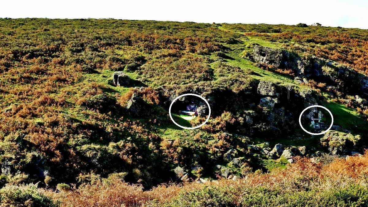
There are two somewhat hidden benches at Black Rock, shown here by the white circles.
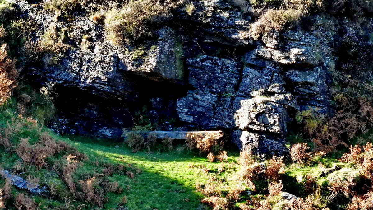
Both seats overlook Black Pool, or Hunter’s Pool.
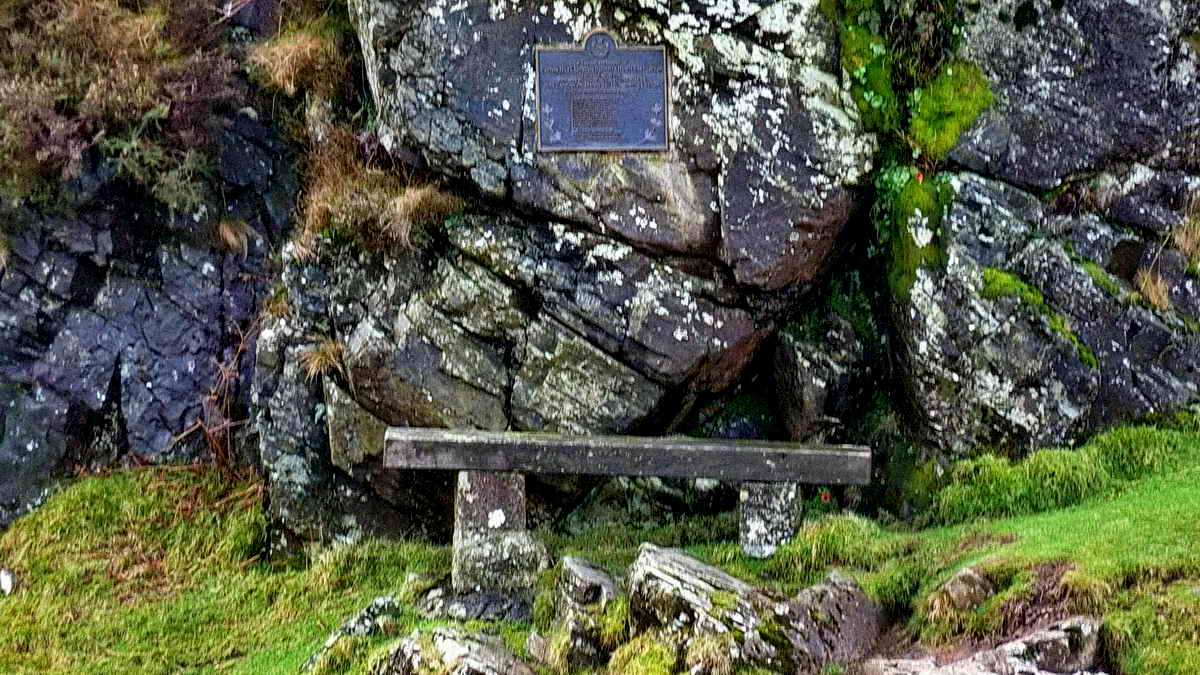
The plaque reads:
IN LOVING MEMORY OF
CAPTAIN NIGEL DUNCAN RATCLIFFE HUNTER M.C. (AND BAR)
ROYAL ENGINEERS
WHO WAS KILLED IN ACTION AT BIEFVILLERS,
NEAR BAPAUME ON MARCH 25TH 1918, AGED 23 YEARS.

HE LOVED THE MOORS OF DEVON, AND ON HIS LAST VISIT
TO LYDFORD, HE WROTE THE FOLLOWING LINES:-


"ARE WE NOT LIKE THIS MOORLAND STREAM
SPRINGING NONE KNOWS WHERE FROM,
TINKLING, BUBBLING, FLASHING A GLEAM
BACK AT THE SUN; E'ER LONG
GLOOMY AND DULL, UNDER A CLOUD,
THEN RUSHING ONWARDS AGAIN;
DASHING AT ROCKS WITH ANGER LOUD,
ROARING AND FOAMING IN VAIN!
WANDERING THUS FOR MANY A MILE,
TWISTING AND TURNING AWAY FOR A WHILE.
THEN OF A SUDDEN OVER THE FALL
AND THE DARK STILL POOL IS THE END OF ALL.

IS IT? I THOUGHT, AS I TURNED AWAY,
AND I TURNED AGAIN TO THE SILENT MOOR.
IS IT? I SAID, AND MY HEART SAID "NAY"!
AS I GAZED AT THE CROSS ON "WIDGERY TOR".
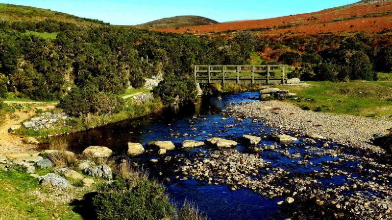
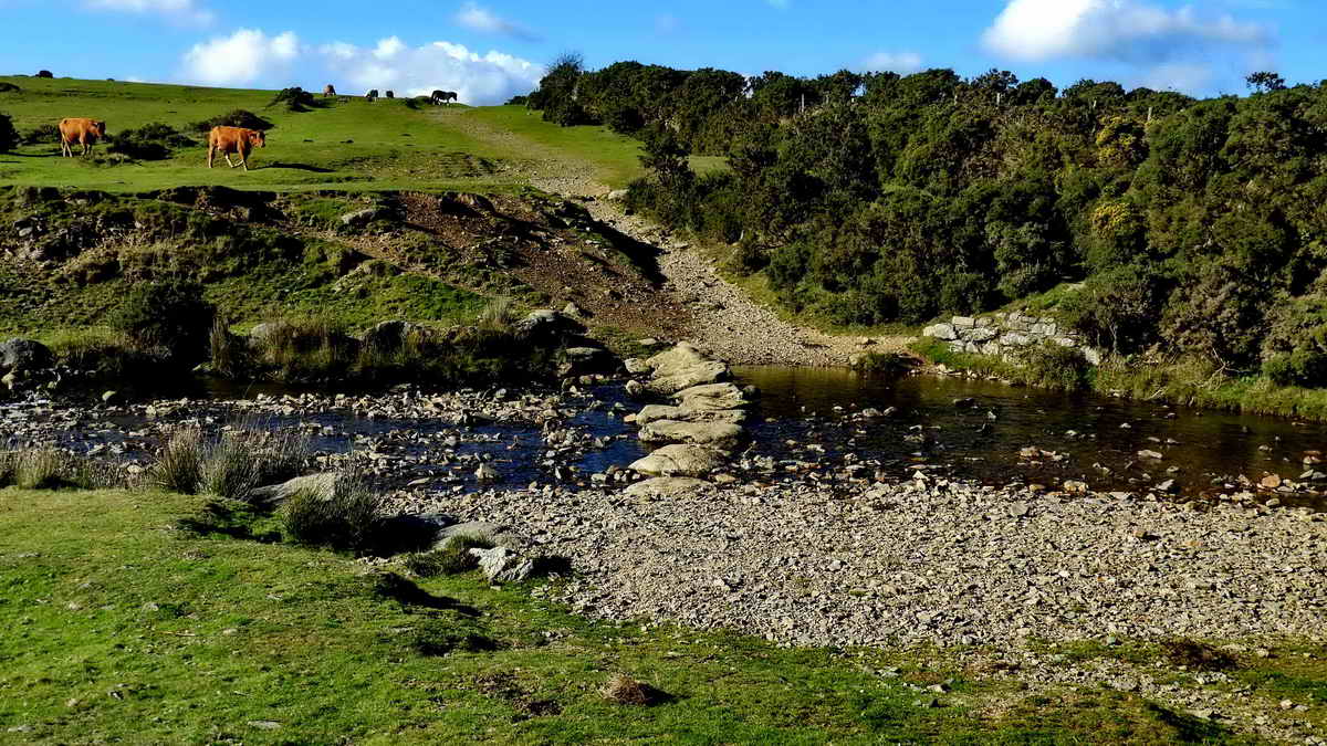
When ready, turn Left and follow the riverbank Northwards to High Down Ford and Bridge
High Down Ford and Bridge

Cross the River and turn right, following the path down on the other bank until you reach and cross the footbridge over Doe Tor Brook
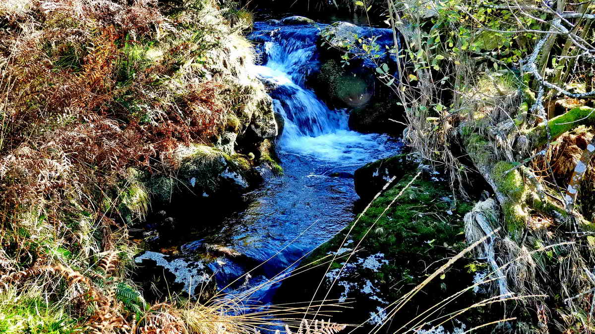
Doe Tor Bridge and Falls
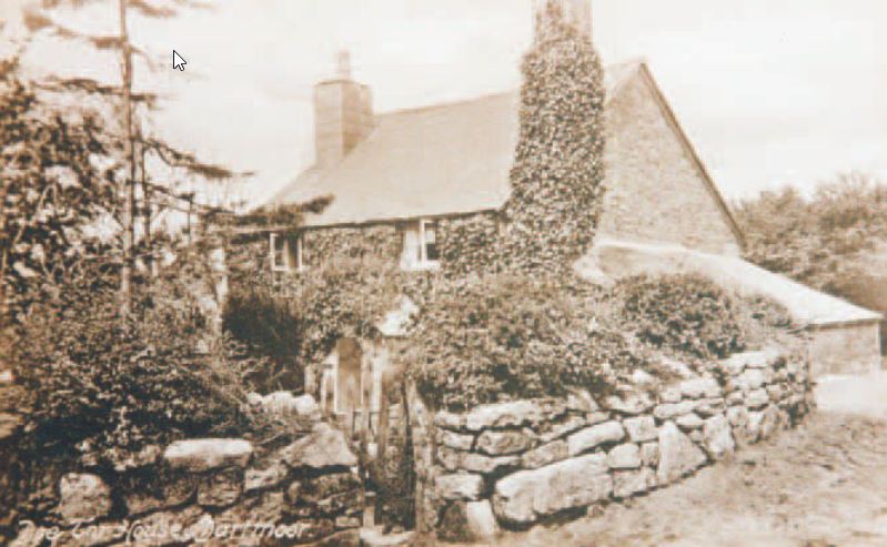
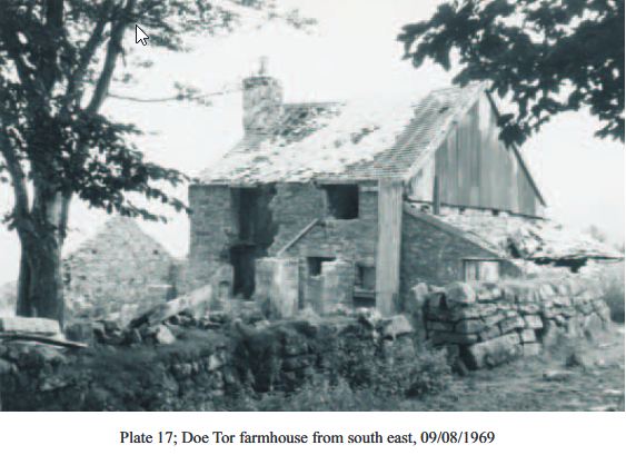
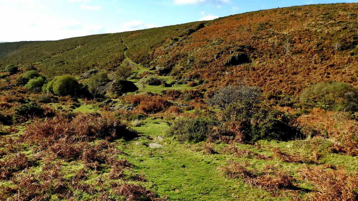
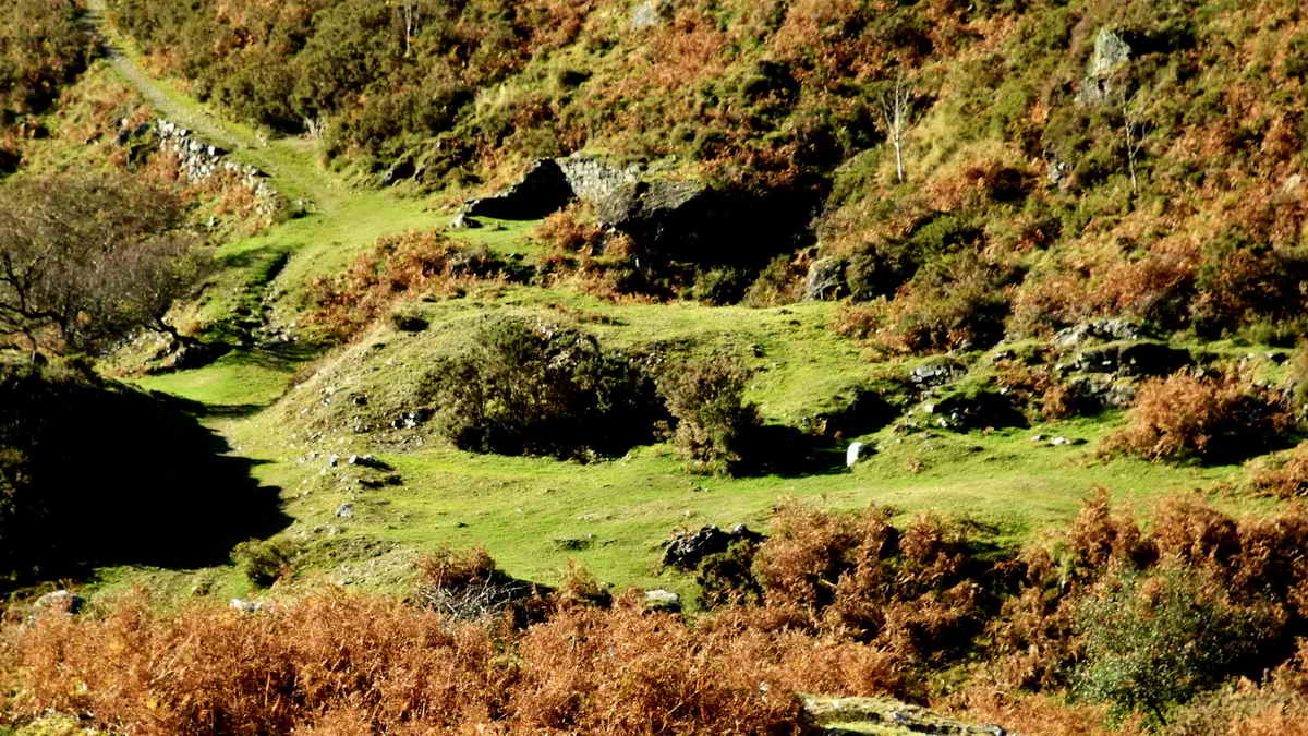
Doe Tor Farm
Doe Tor Farm is a post-medieval farmstead dating to the mid 18th century and was abandoned around 1955 as uneconomic or uninhabitable.
A perfect prehistoric flint scraper was found here in 2001 proving man’s presence here around 4,000 to 5,000 years ago.
The MOD commissioned an extensive site survey report which is linked below. It’s very recommended to read as it includes a lot of well written information and interpretation, including human interest from the people who farmed here.
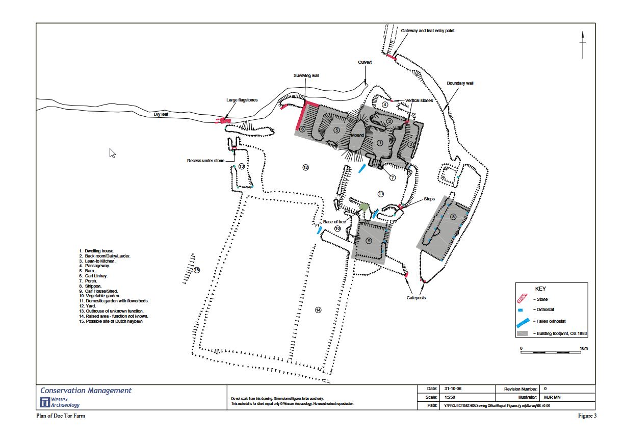
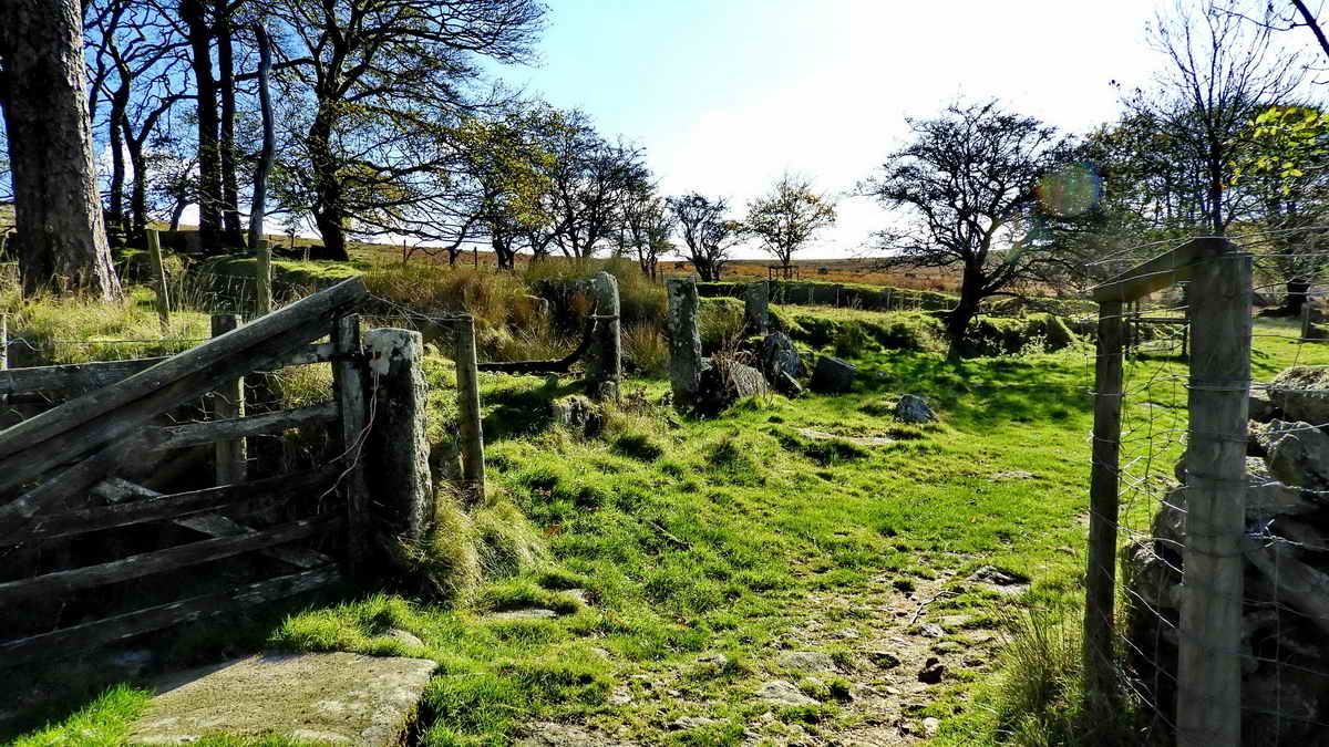
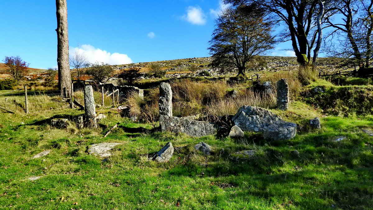
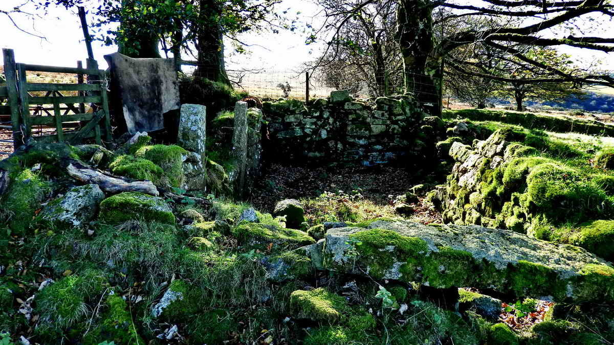
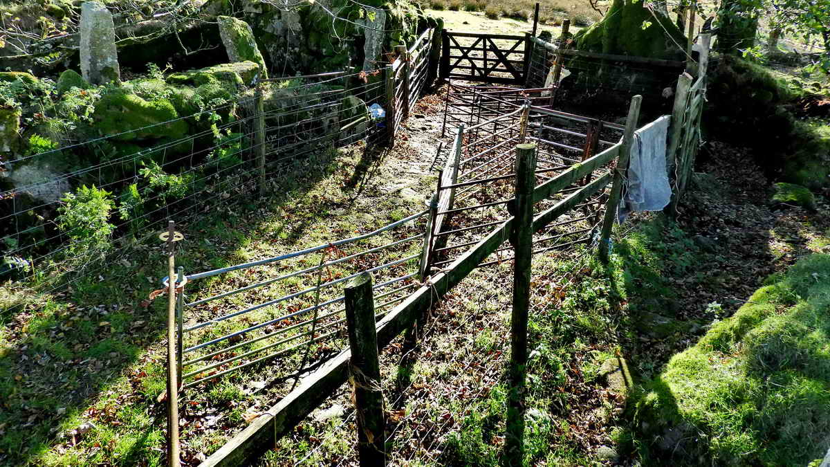
The lane is now used for penning/inspecting animals, hence the hurdles. The top left area in this picture are the ruins of the Shippon. The ruins to the top/right are the Calf House.
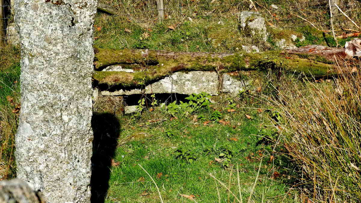
There is apparently a millstone built in the walls hereabouts, but possibly now overgrown by turf.
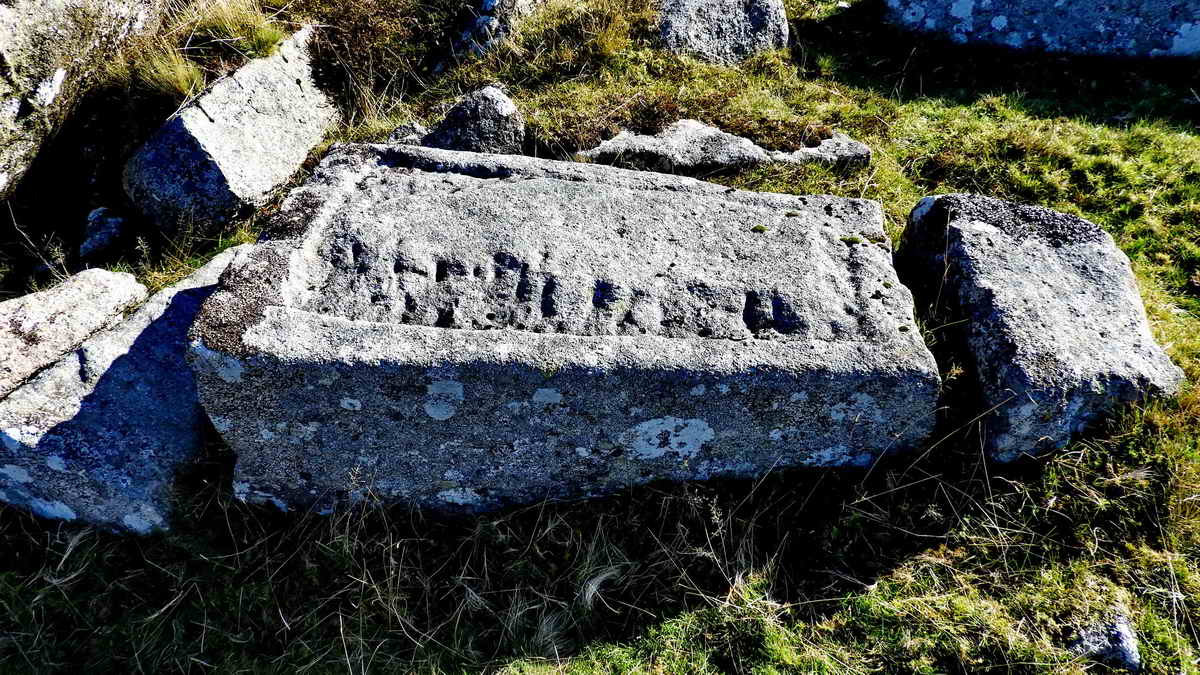
The above stone was well documented here. Flat on one side and curved on the other, to run against the outer curve of the circular trough. It was reported stolen in 2005.
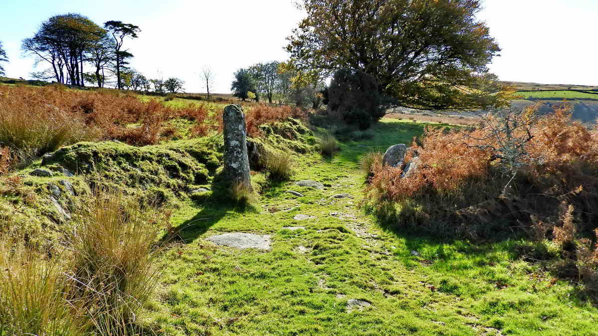
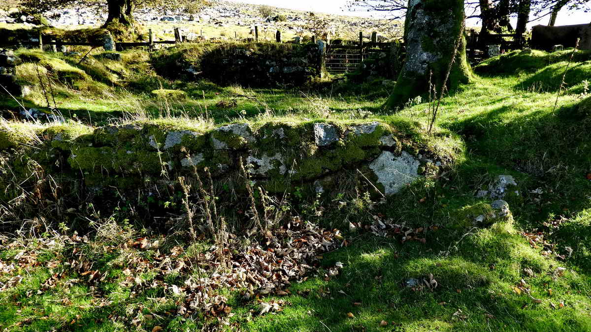
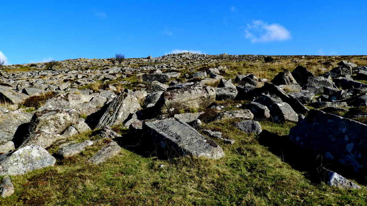
Doe Tor
This trough was abandoned soon after carving started. It’s on the near slope of Doe Tor, about 125 meters from the house.
Return route - a choice
When you leave the farm and cross over Doe Tor Bridge, you can either return back up the river to High Down Ford and, after crossing the Lyd, follow the hedge back to the car park taking in the mining site of Wheal Mary Emma tin mine.
Alternatively, if the weather is kind and the water level is low you may wish to brave a river crossing by some stepping stones. This path is marked in purple on the map and the rest of the description here follows that trail.
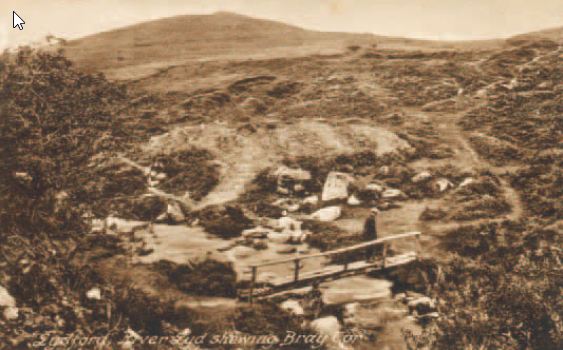
Wheal Mary Emma (Purple Route)
Wheel Mary Emma was a tin mine built on the River Lyd some time between 1849 and 1900. The larger ruined stone building was likely a blowing house for producing tin ingots from the crushed ore.
There is still evidence of a banked-up track above the flatter dressing floors, with two round buddles. Next to these is a filled in wheelpit where water from the Lyd was diverted to drive a 30-40 foot water wheel, providing power to the whole mine site for pumping, ventilation and even driving the buddles. A stone-lined tunnel runs from the bottom of the wheelpit to the river bank below the scarp to let water drain back once it had done its job of turning the wheel. There was at least one shaft dug to extract tin on this site.
When done exploring the mine workings, follow the path up the hill due West, which will take you back to the car park and conclude our walk
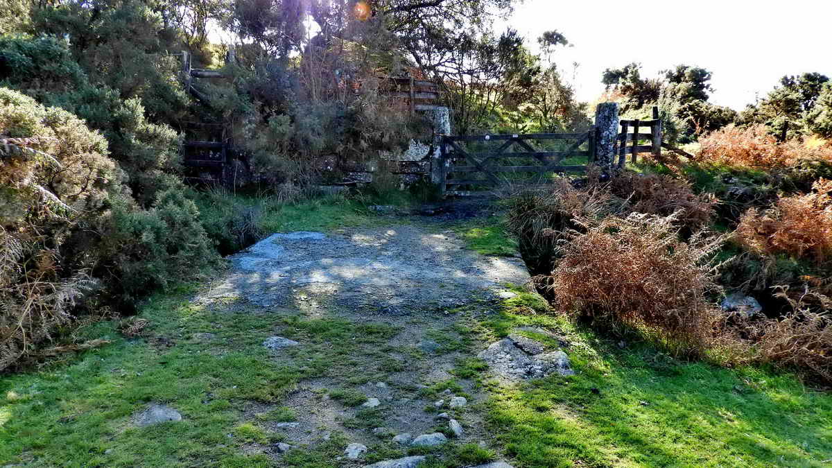
Parking
The approach road to the free parking area is a little bumpy, but the parking itself is quite large and good.