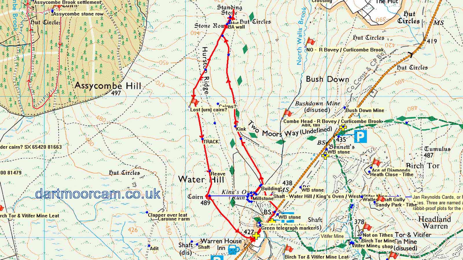
Information
- Distance: 3 miles
- Grade: Medium
- A GPX route of this walk is available: Download GPX
- Directions to Car Park
- What Three Words
treaty.kingpin.budding
Map
Introduction
This short walk starts at the Highest Pub in Southern England and climbs the gentle hill behind it, visiting several ancient sites on the way such as the Kings’ Oven to the impressive Hurston Stone Row. We then return along a low ridge to another cairn atop Water Hill, before dropping back down to the starting point. The views are impressive, and although never far from the road, it’s possible to lose sight of modernity and step back in time in one’s imagination to when this area was a thriving tin mining valley, or even further back to the bronze age when it was also busy with several nearby settlements.
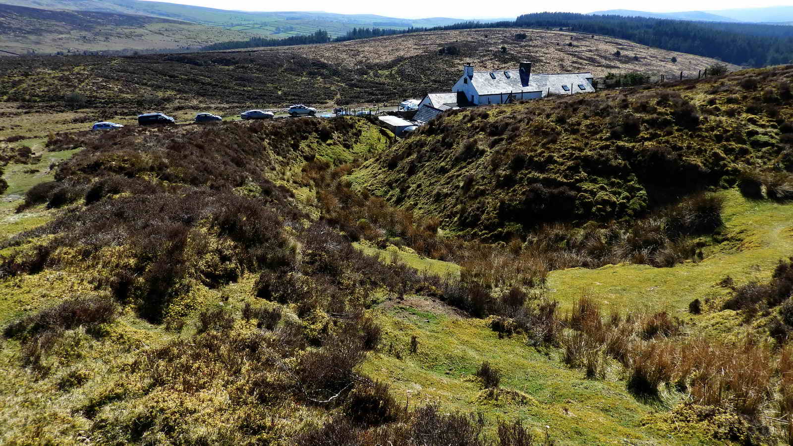
Warren House Inn
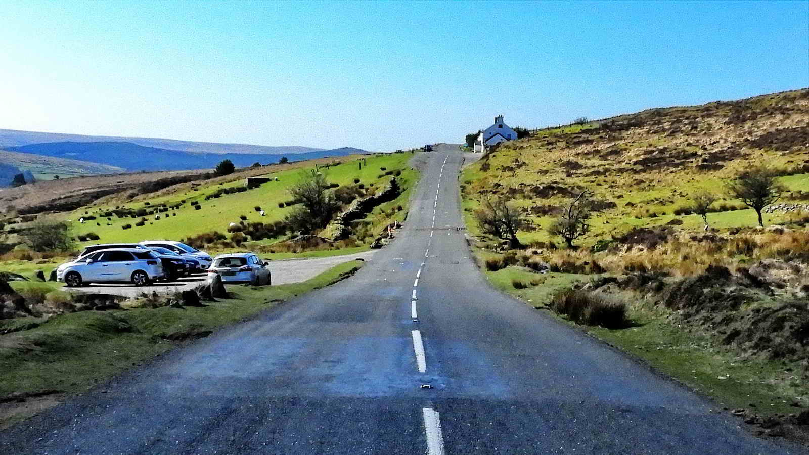
This pub claims to be the most famous pub on Dartmoor and is certainly one of the most visited, especially on a Summer’s day. When the prison was working, visitors would often stop by here on their way to visit friends and relatives.
At 434m above sea level, it’s the highest pub in Southern England and the second highest overall. It claims to have kept its fire burning continuously since 1845, which must make for exciting work as the pub’s chimney sweep.
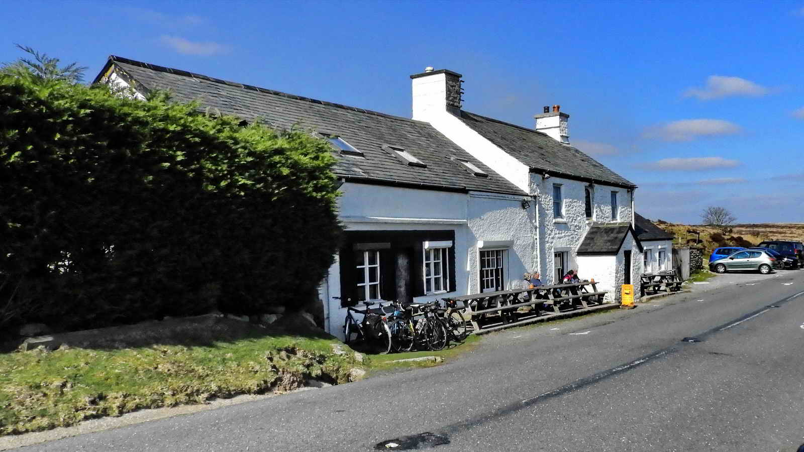
Originally named New House and built in 1751, it was then positioned on the opposite side of the road where the foundations can still be seen. In 1845, the pub was rebuilt and renamed to the “Moreton Inn” to serve the thriving tin mining industry that was literally on its doorstep, with Vitifer and Golden Dagger mines only a short distance downhill.
Shortly afterwards it was renamed to its present title for the Headland Warren that was built nearby to give the miners a steady supply of meat.
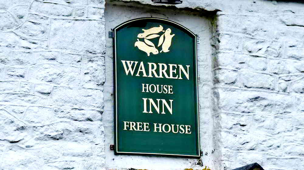
The sign of the tinners’ three rabbits (sometimes called The Three Hares). This is often seen carved in Churches near mining areas, and usually the rabbits share only three ears between them.
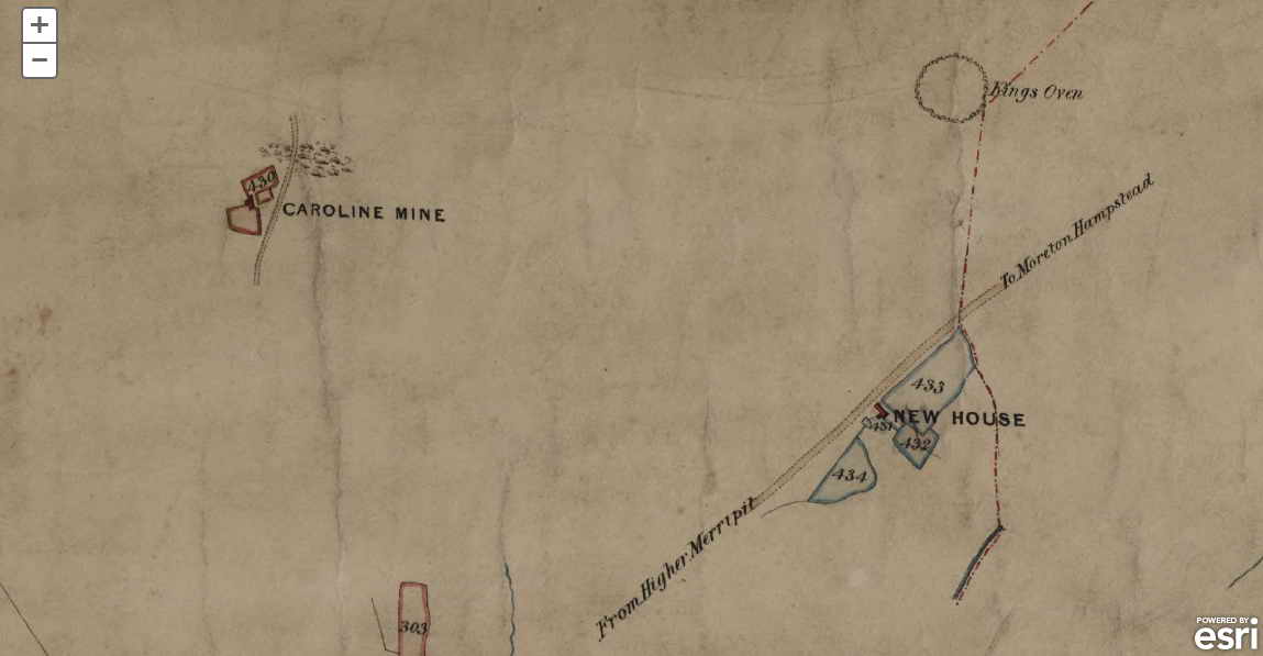
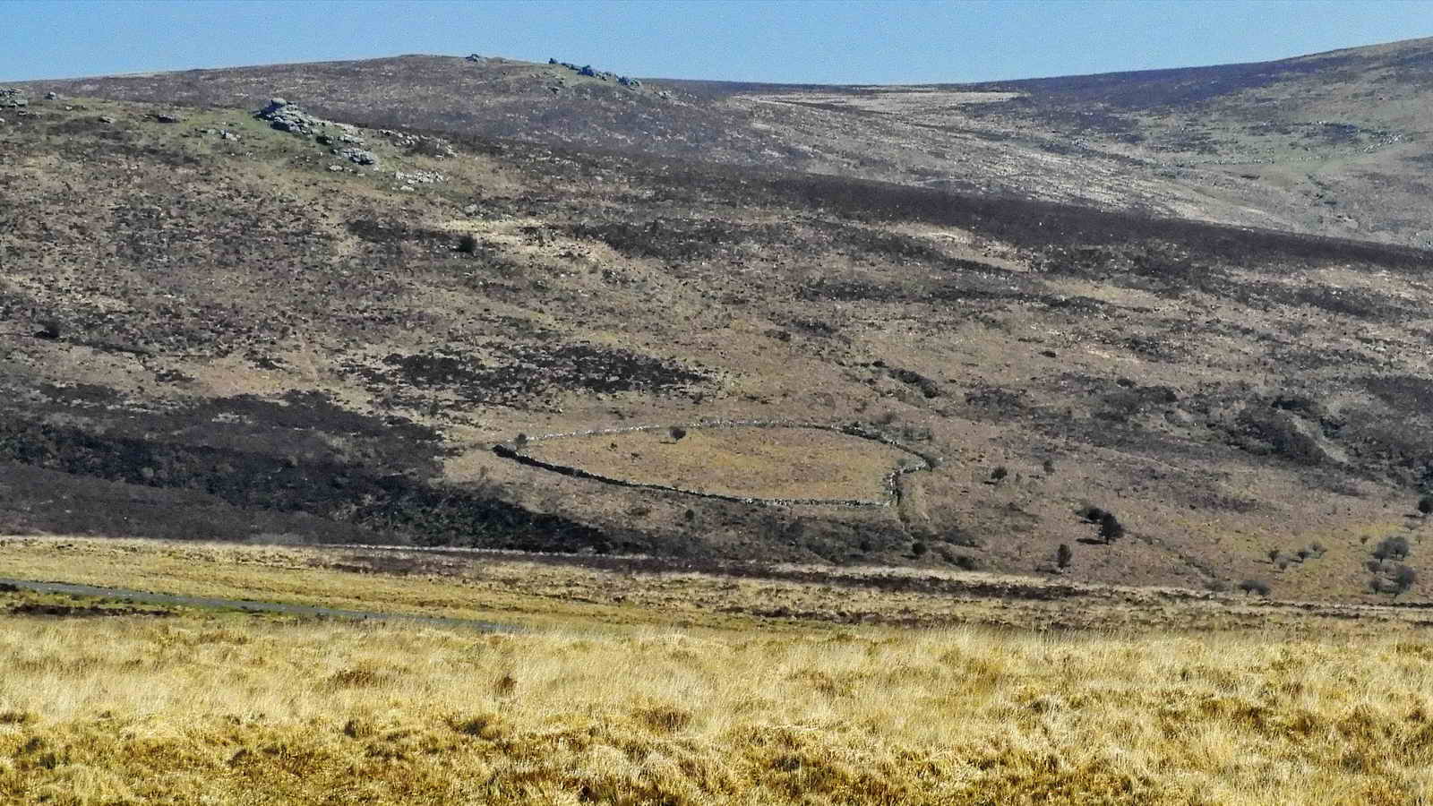
Headland Warren
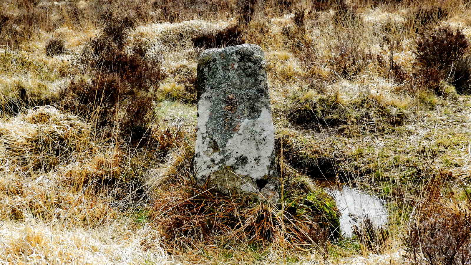
The letters WB are difficult to see now, occupying the upper six inches on the face of the stone. This is one of a series of 15 similar stones that mark the bounds of Headland Warren, where rabbits were bred to feed the miners. Warren House Inn is named after the warren. The “15” bound stones includes the large Bennet’s Cross, which stands tall and proud to the side of the road, also marked “WB”. The stones date from around 1780 – (Dave Brewer, 2002, Dartmoor Boundary Markers, pp. 265-268)
“Benet’s Cross stands at the roadside, a tall roughly hewn cross with a distinctive bend in the shaft, inscribed on its north face the letters ‘WB’. The original purpose of the cross is uncertain — it may have been a route guide post, or a bond mark of lands owned by Buckfast Abbey, or perhaps both. The name should be spelt with a single ‘n’ and a single ‘t’ — though few people seem to do so — for it is derived from the Benedictine order of monks, indicating its former association with the original monastery at Buckfast — this was at first a Benedictine abbey, as also is the present one, but was a Cistercian monastery from the thirteenth century until the Dissolution. The cross also acted not only as a boundary marker for Headland Warren, to which the letters refer (WB = Warren Bounds), but also for the Vitifer and Birch Tor mining setts, as well as being a bond mark on the Chagford/North Bovey parish line, a purpose which it still serves today. A curious coincidence is the fact that a William Bennett was a representative of Chagford Stannary in the time of King Henry VIII, and he would have undoubtedly had some indirect connections with the earliest tin-streaming activities in the area.” — Mike Brown (2001) Guide to Dartmoor
Carp’n Moses Bungalow
Near to our parking are the ruins of a stone-built bungalow that belonged to Cap’n Moses, once captain of the Birch Tor & Vitifer Mine nearby. The bungalow was also known as King’s Bungalow (after King’s Oven) and it was demolished in 1976.
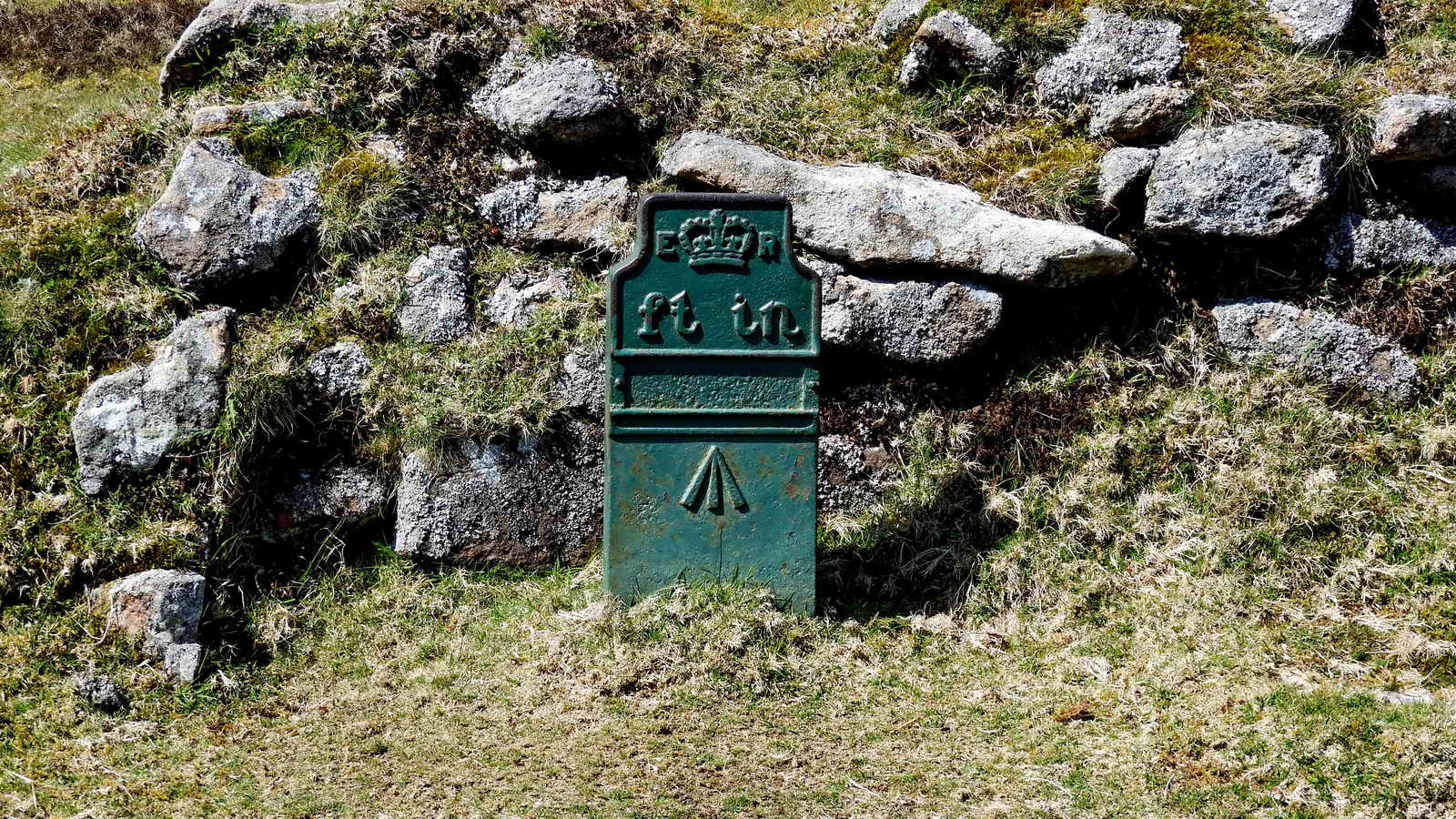
This green cast iron item is a Telegraph Marker. There are thirteen of these items between Moretonhampstead and Tavistock. They marked the route of underground telegraph cables placed in the late 19th and early 20th centuries. After bad blizzards of 1891, a need was seen to create more reliable communications after overhead telegraph cables were damaged and made inoperable.
Starting our walk
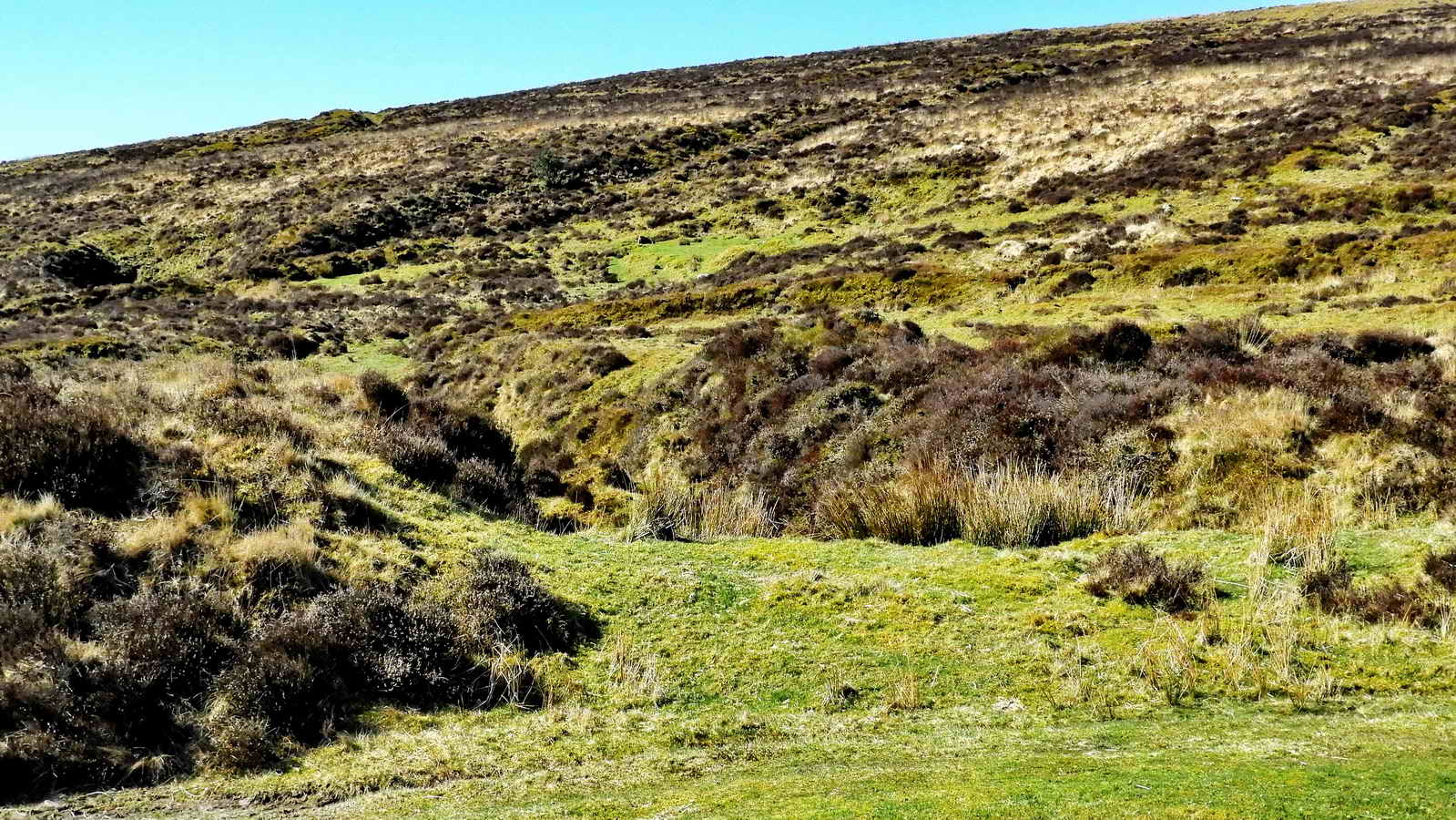
When ready to depart, follow the track directly off the road as seen below
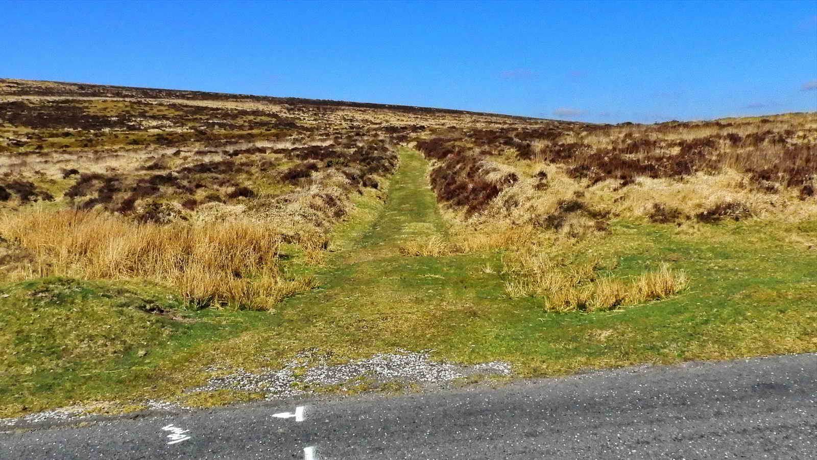
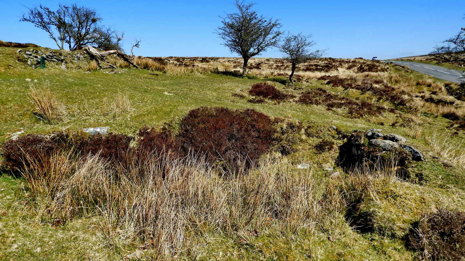
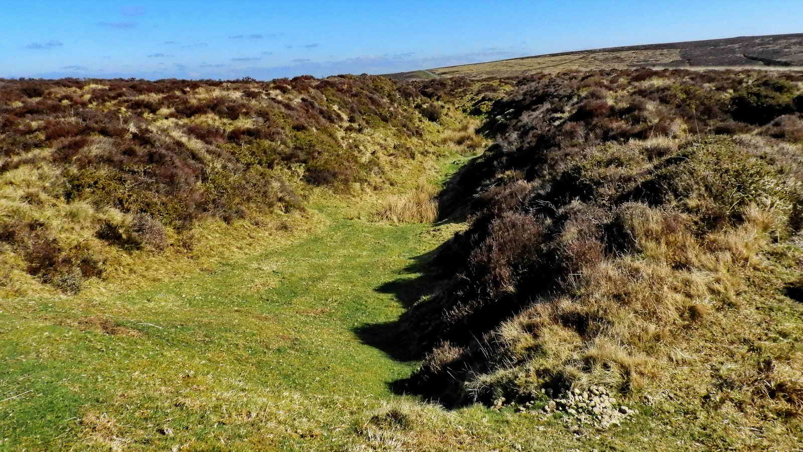
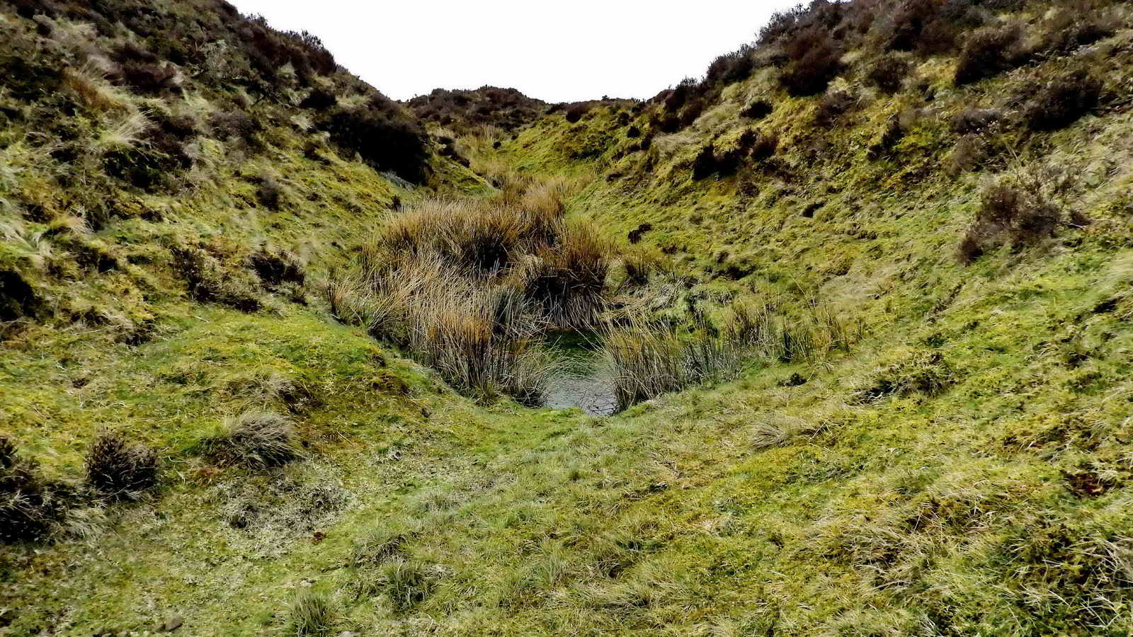
The start of the walk is an ancient trackway to the open workings of the Water Hill Mine that has extensive diggings on this hillside. There is a large gert (A mining remain where tin was washed out of the rock) right behind the Warren House Inn that approaches from the west - this being the direction of the Caroline Mine. The Water Hill MIne workings extend rightwards in this photograph, towards Moretonhampstead, towards the workings of Bushdown Mine.
- Heritage Gateway MDV27841 - Tin Working on South Side of Water Hill
- Heritage Gateway MDV54593 - Vast open cut on Water Hill
Tin was the prime motive for the mining of this area, specifically Casseterite.
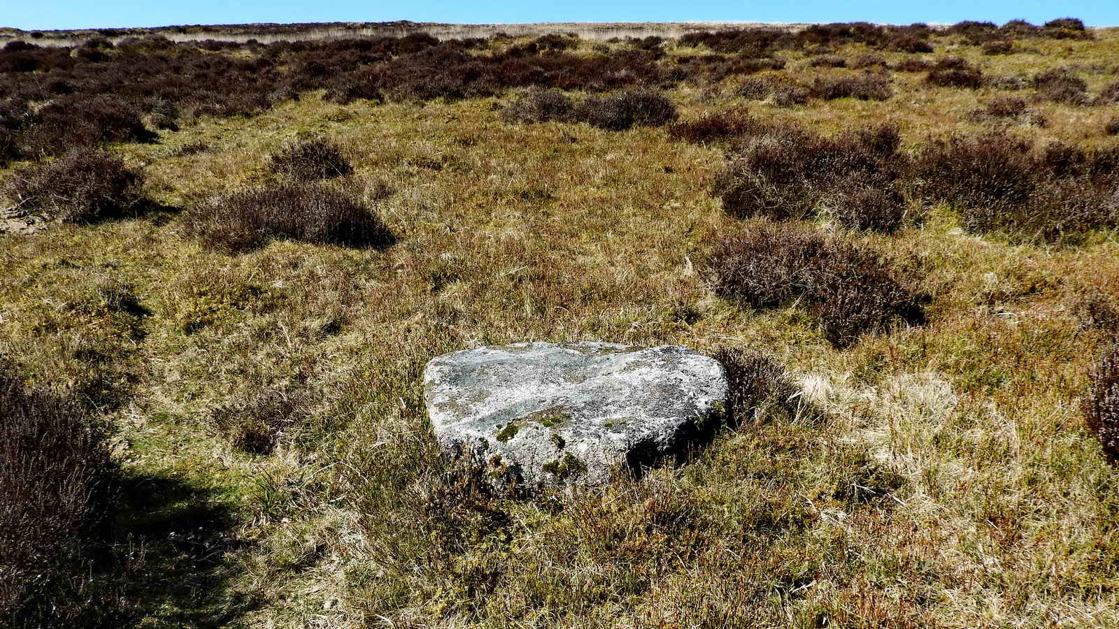
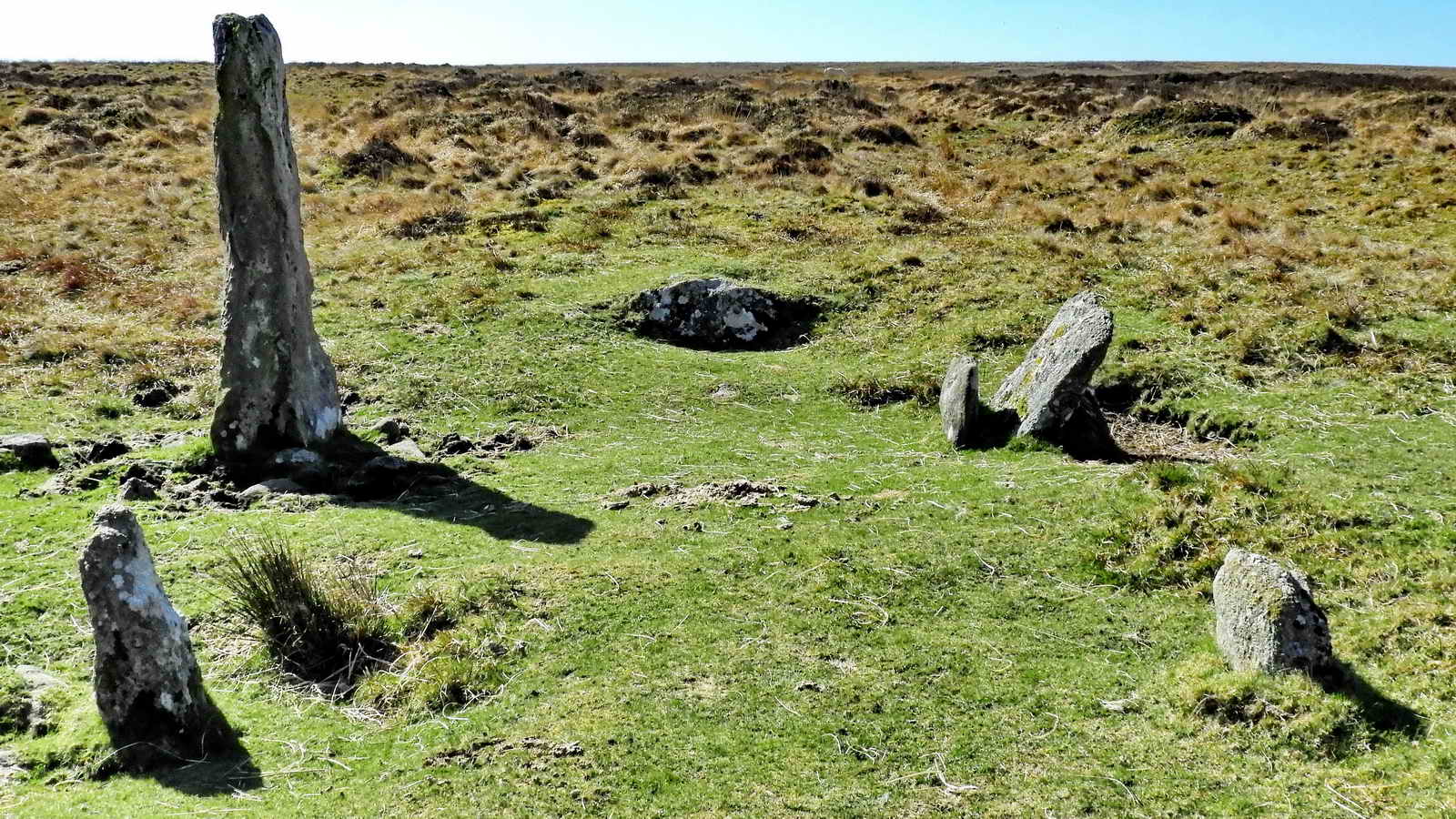
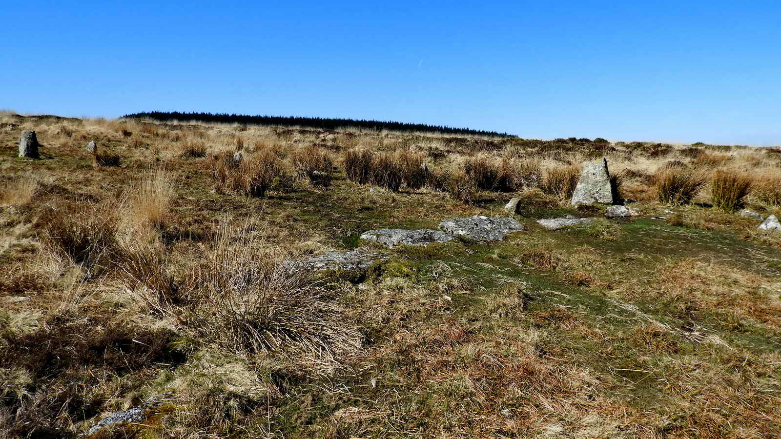
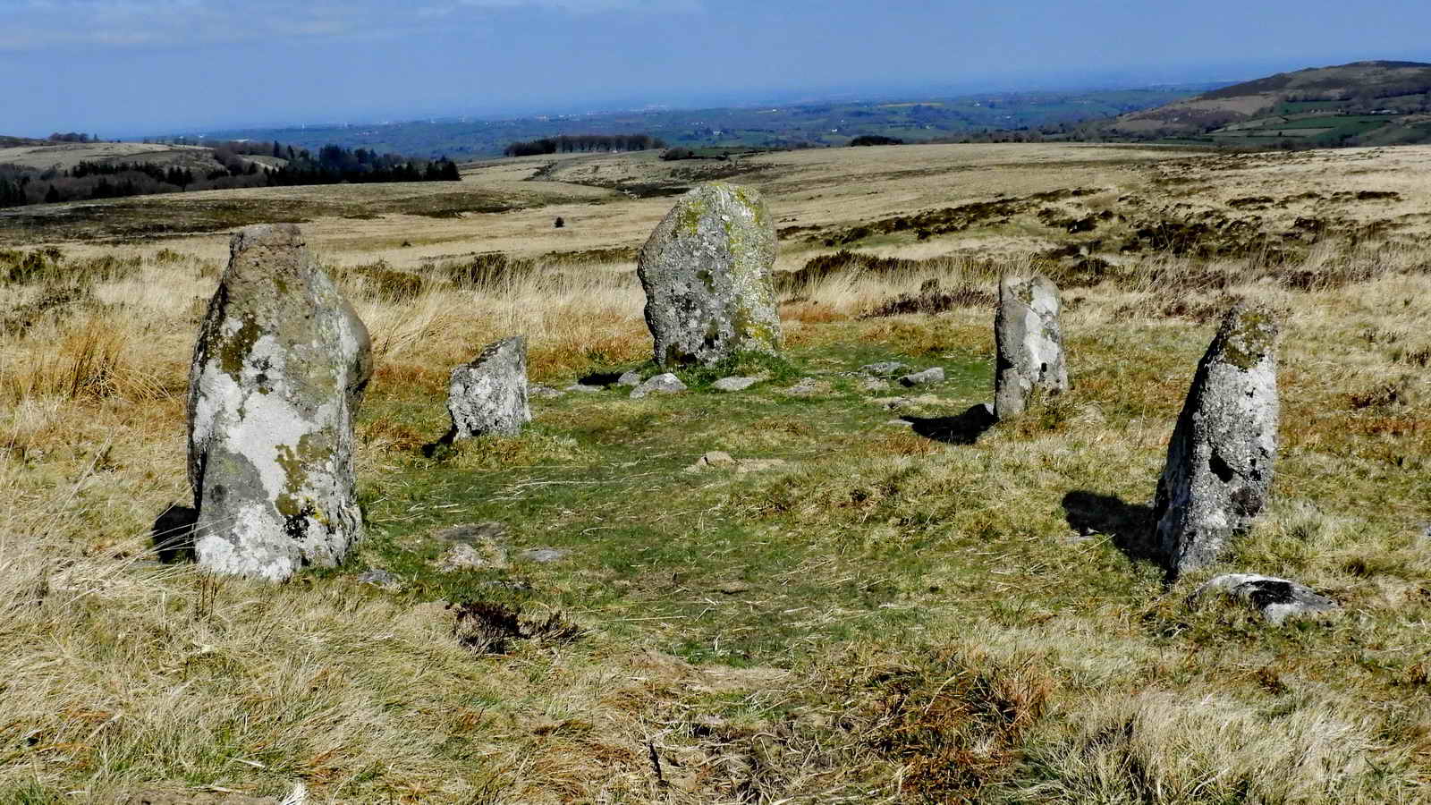
Kings’ Oven and V-Stones
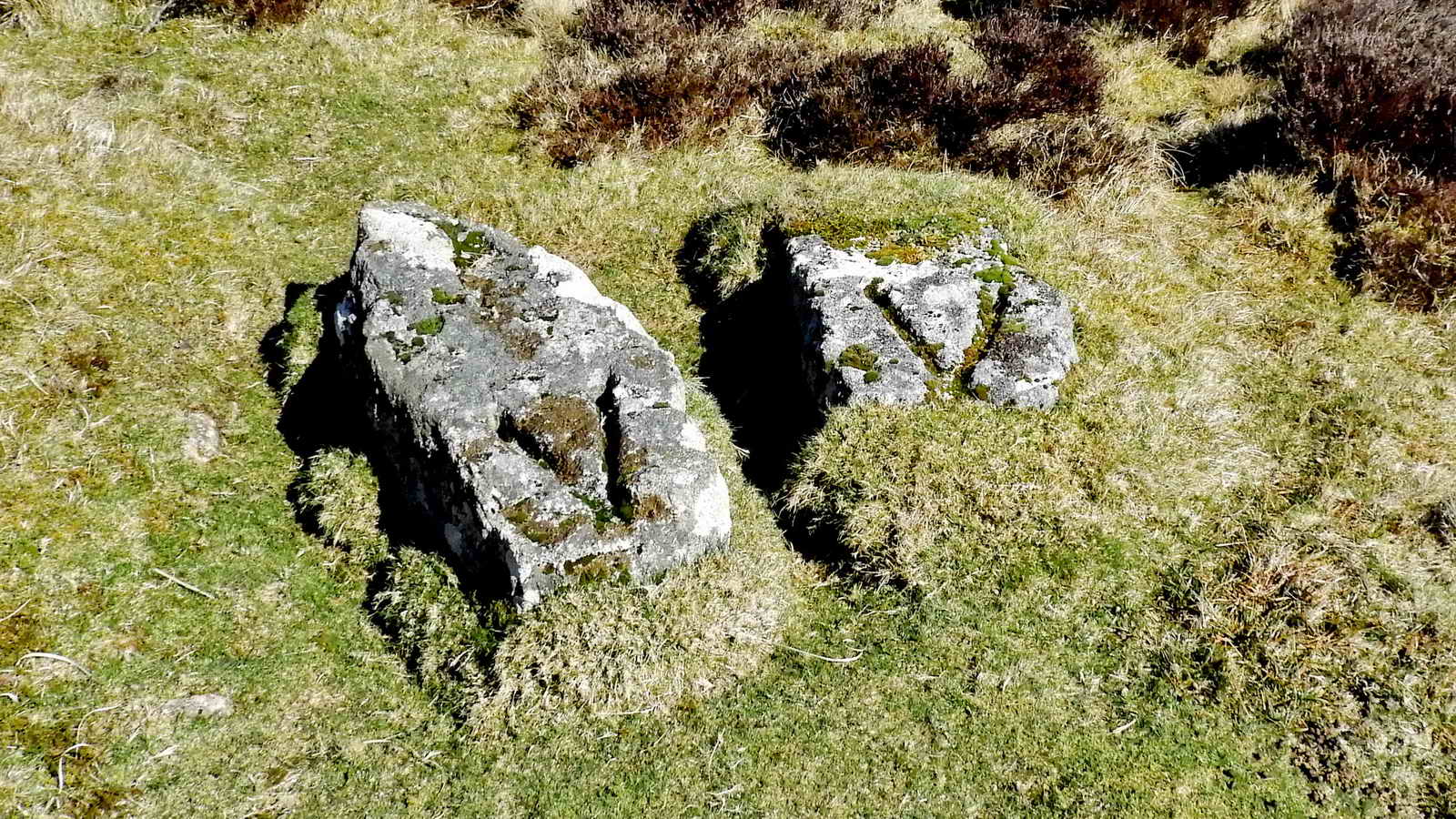
One of Dartmoor’s mysteries, the V stones - no-one knows what these are. It has been suggested they might be for the base of machinery, the base of a flagpole, a mould and I’m sure, many other things. (See plan below for location)
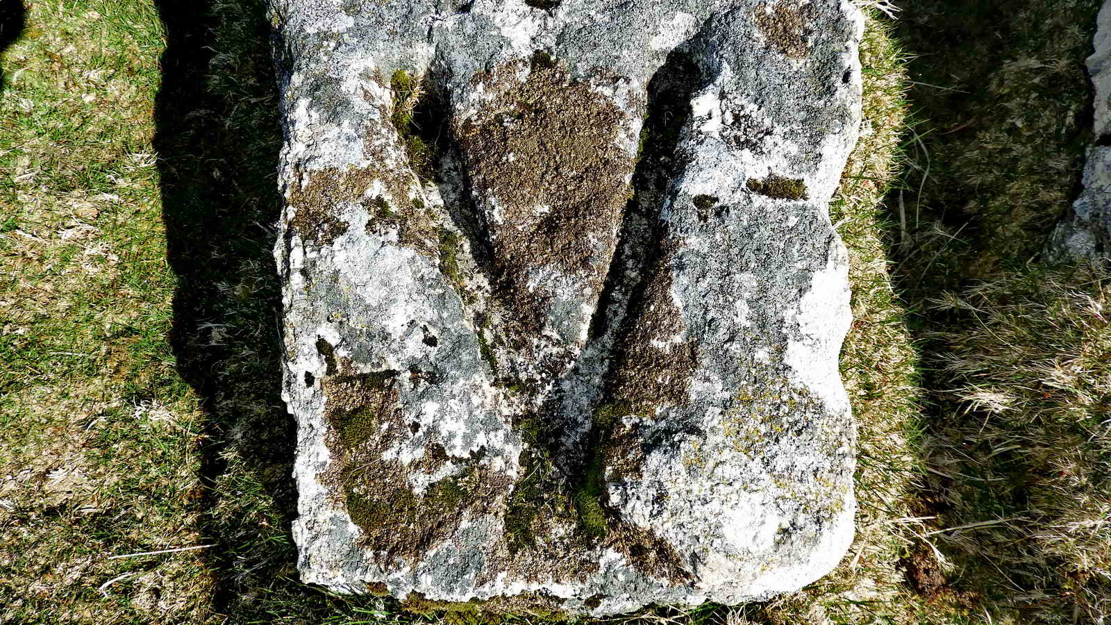
Two theories:
The DTRG (Dartmoor Tinworking Research Group) Newsletter May 2020 No. 58 has a note on the “Kings Oven Stones” by Nick Walter on pages 9-10 that proposes a possible function for these stones. They could have been supports for a hand windlass that could have been used for raising loads from a small shaft in the nearby mine.
The next issue of the same DTRG Newsletter, dated November 2020 No. 59, has a note on the “Kings Oven Stones” by Tom Greaves on page 19. The stones may have derived from a single stone that is now broken. The cut recesses could have housed the base (wood or metal) of a flagpole. They are situated near the foundations of the larger of two ruined buildings which might have been the mine office. It is recorded that at least one mine in this area flew such a flag when they were actively working.
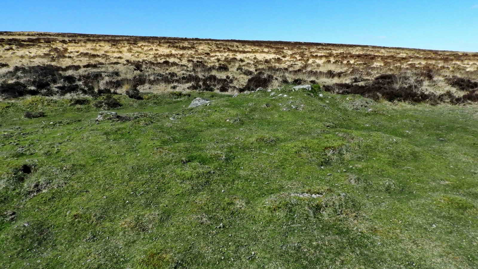
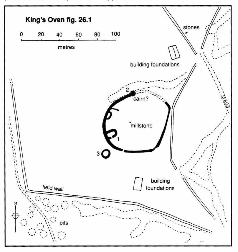
King’s Oven or Furnum Regis (in Latin). This derives from the fact that this is thought to be the site of an early smelting house, hence “oven”, the produce of which would be taxed by the King via the stannary towns, such as Chagford. Furnum Regis appears in the 1240 Perambulation of Dartmoor, although more likely mistaken for the landmark cairn at the summit of Water Hill.
- Heritage Gateway MDV6620 - Cairn and cist at King’s Oven to the east of Water Hill
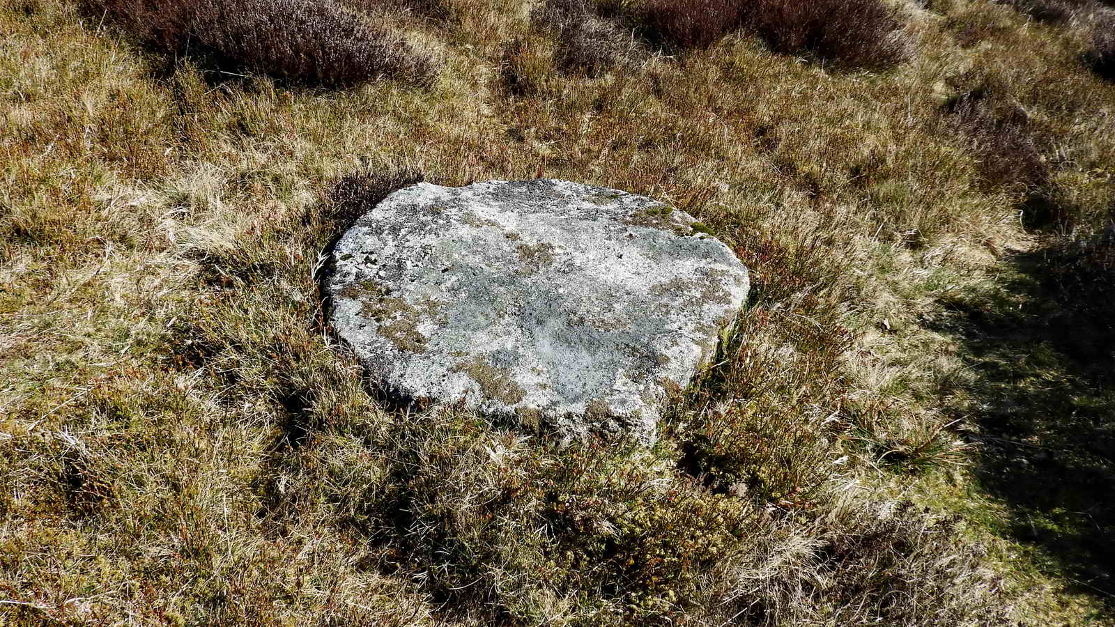
- Heritage Gateway MDV46484 - Millstone at King’s Oven Pound
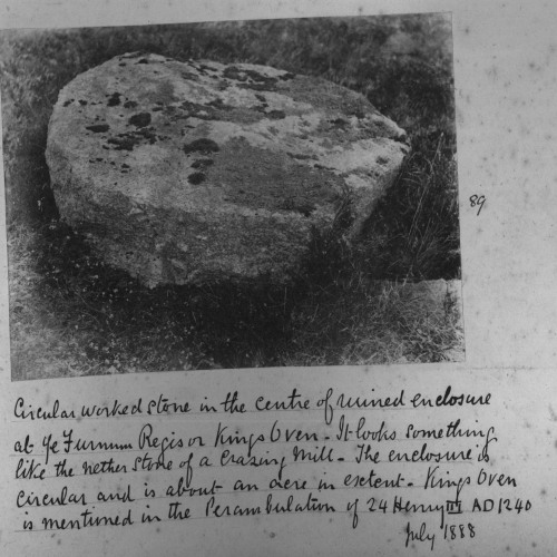
Description: “The enclosure at King’s Oven is probably the site of medieval tin mining activities. Burnard comments that ’the enclosure is circular and an acre in extent’. Burnard notes that the stone ’looks something like the nether stone of a crazing mill’. A nether stone is the lower stone of a rotary crazing mill that was used for grinding tin ore. Crazing mills could only grind the alluvial gravels and they were replaced by stamping mills when coarser ores started being mined. In Newman’s //Dartmoor Tin Industry Field Guide// he states that only three crazing mills are known on Dartmoor at Sheepstor, Outcombe and Gobbet. Perhaps the stone photographed by Burnard in 1888 is evidence for a fourth crazing mill but the stone is no longer in situ today. King’s Oven was previously known as Furnum Regis and was mentioned by this name in a Perambulation of Henry III in 1240. However by 1609 in the Dartmoor Forestry Survey the location was known as King’s Oven.”
The fact that Furnum Regis, the King’s Oven (taken to imply a smelting place for tin), is a landmark in the 1240 Perambulation shows that tin was important as far back as the 1200s. The diggings in the area must date from that period - 800 years ago!
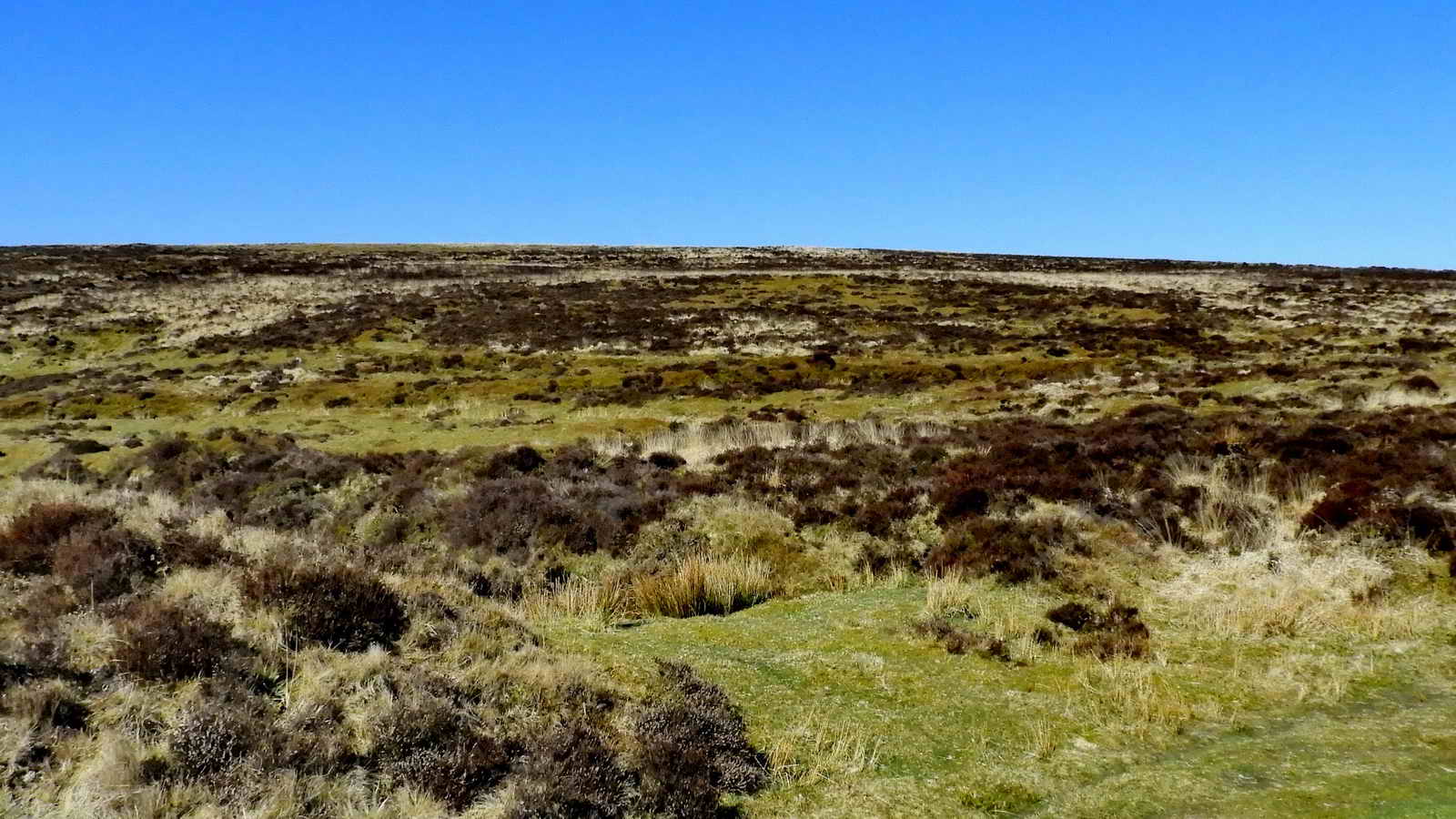
When ready to leave Kings’ Oven, follow the smaller path to the Northwest along the contour
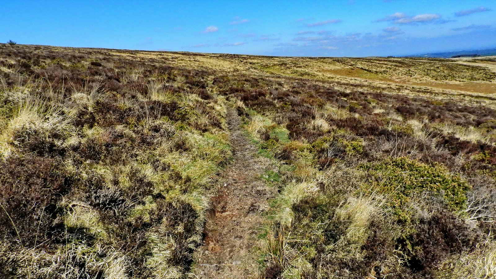
The local name for these paths are varied and include; Pixie Path, Peat Path, Hobbit Trail, Pony Plod (from the packhorse days) or Sheepway
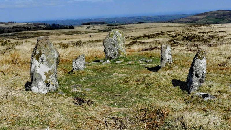
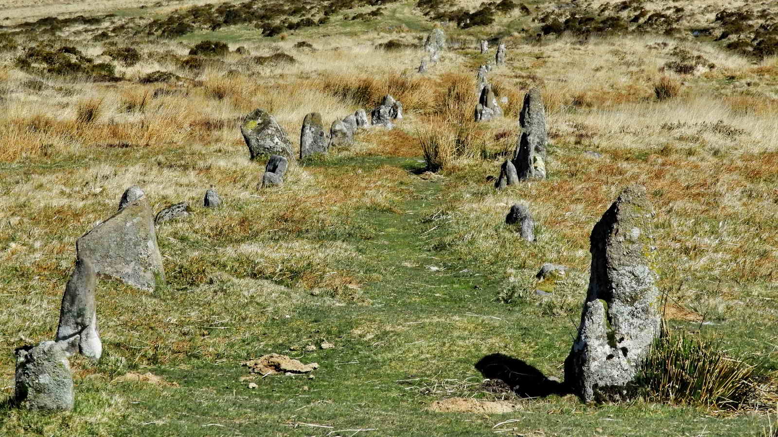
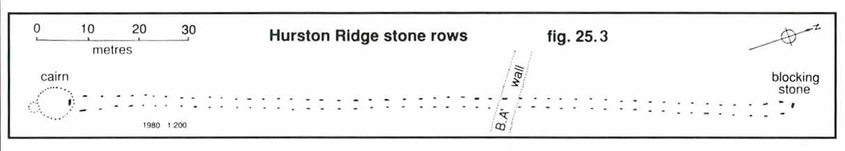
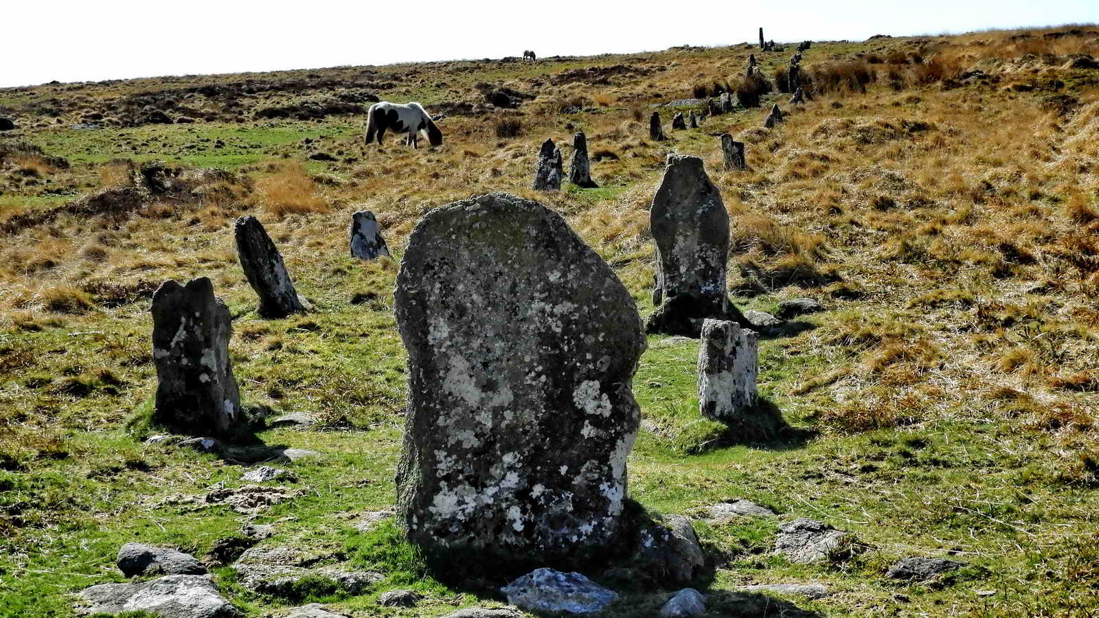
Hurston Ridge double stone row
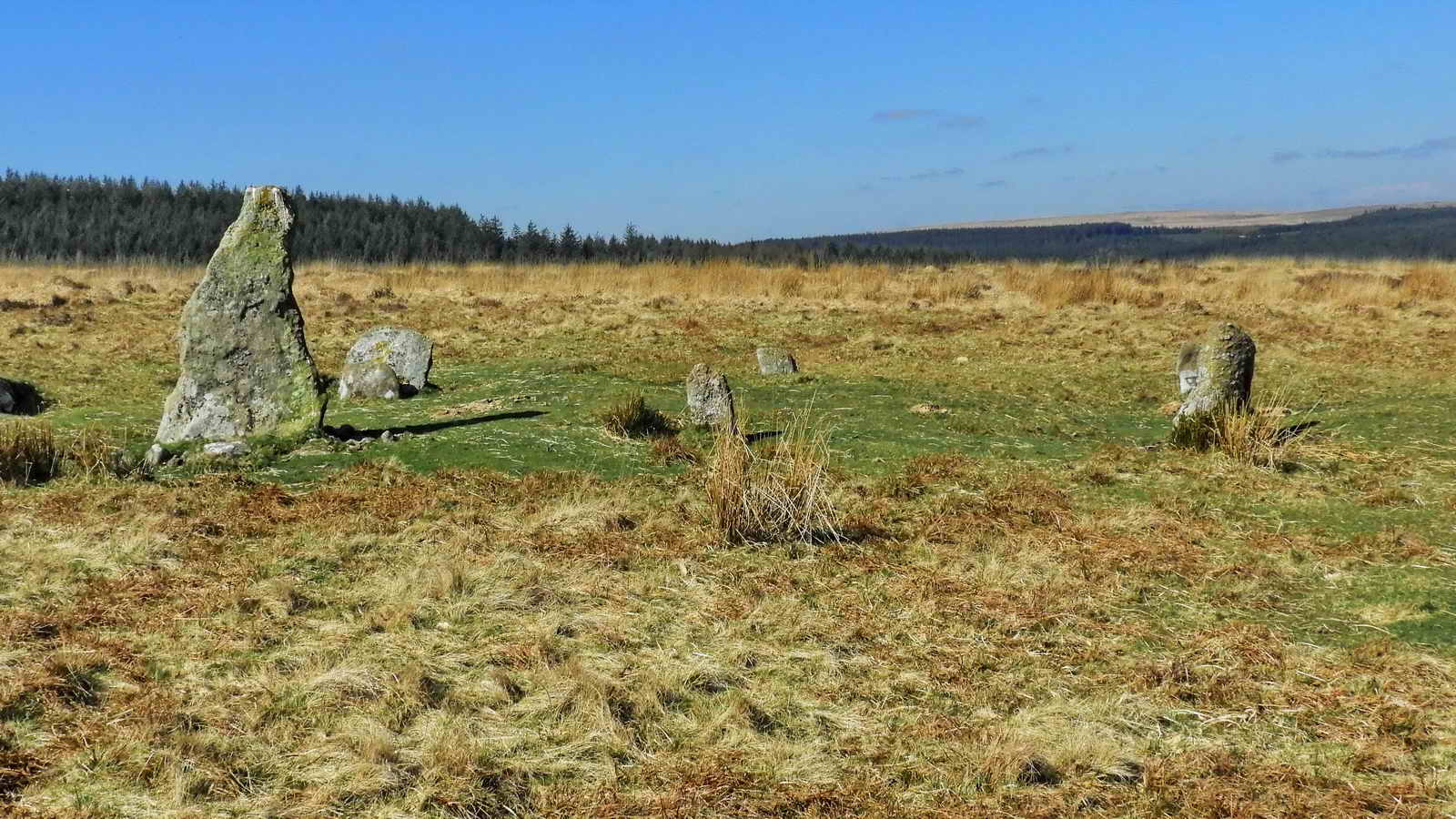
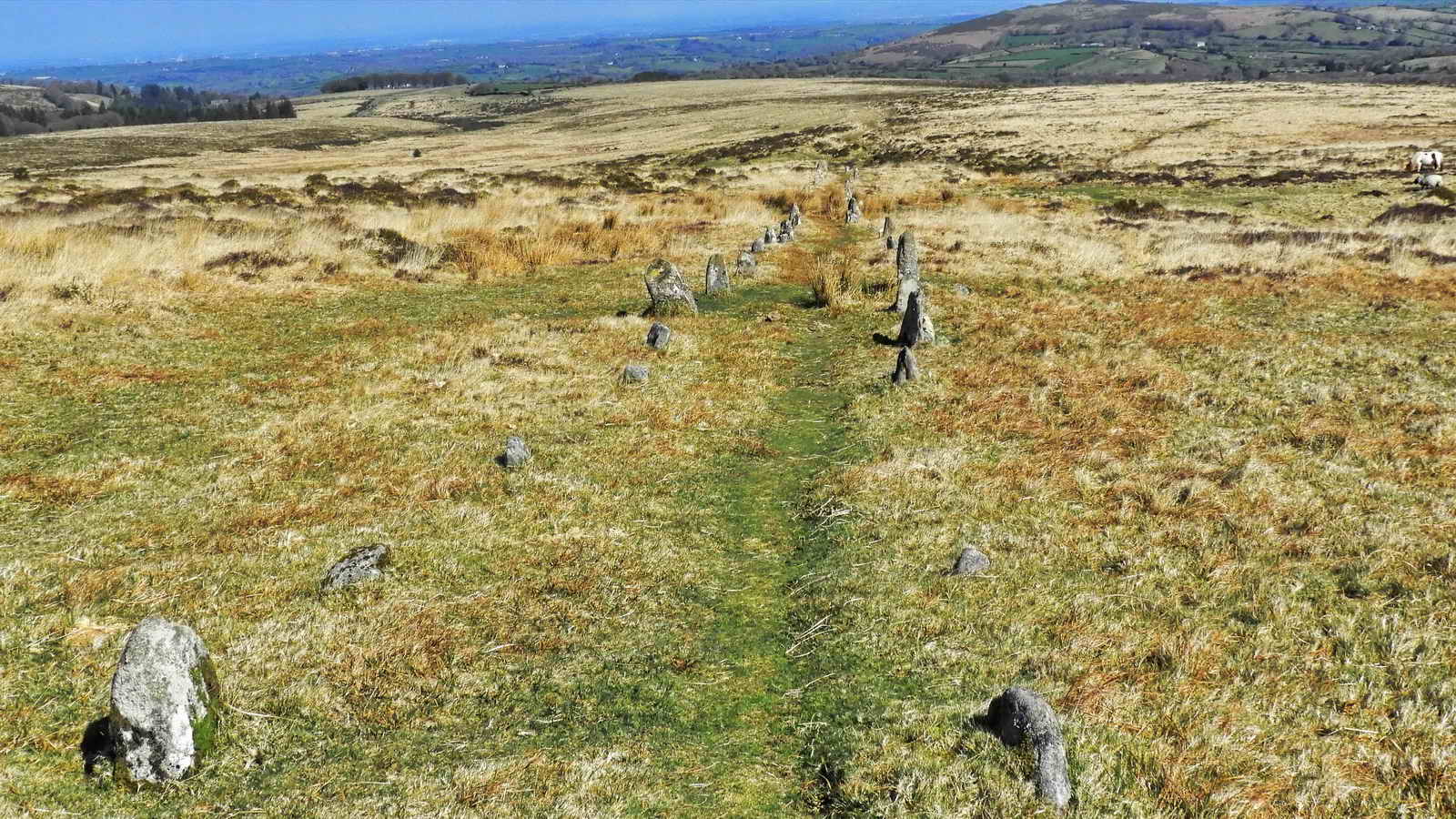
One of the best examples of its kind, mostly in its original state. There are 99 stones arranged in 49 pairs. There is a cairn at this upper (south-west) end, visible from the blocking stone at the lower end. Orientated NE-SW.
Somewhere in this area is a “lost” cairn described by J. Butler (1991), Dartmoor Atlas of Antiquities. The cairn was discovered and excavated by the Dartmoor Exploration Committee in 1900 and then it was “lost” again, shortly afterwards.
During investigations on the cairn by Baring Gould, a “stone axe and a cinerary urn” (the latter upturned and covering a small heap of cremated bones on a flat stone, covered by a slab) were found. A photo of the restored Middle Bronze Age urn (1500-1000 BC) can be seen here (Credit: Legendary Dartmoor) The pattern around the rim is believed made by impressing the clay with a twisted cord. It was restored 1960-1962 and was put on display in the Plymouth Museum.
When ready to leave the stone rows, follow the map to the Southwest, and then South to Water Hill a mile or so back towards the road
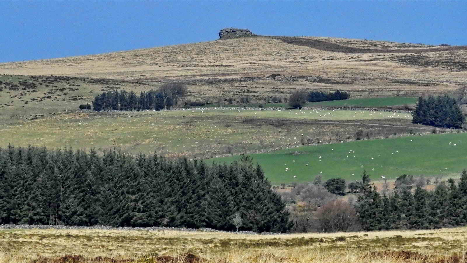
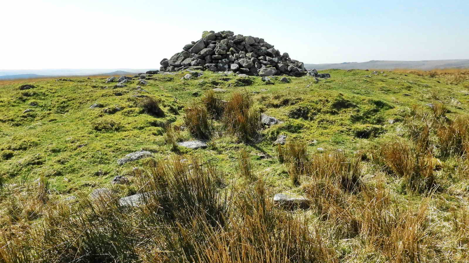
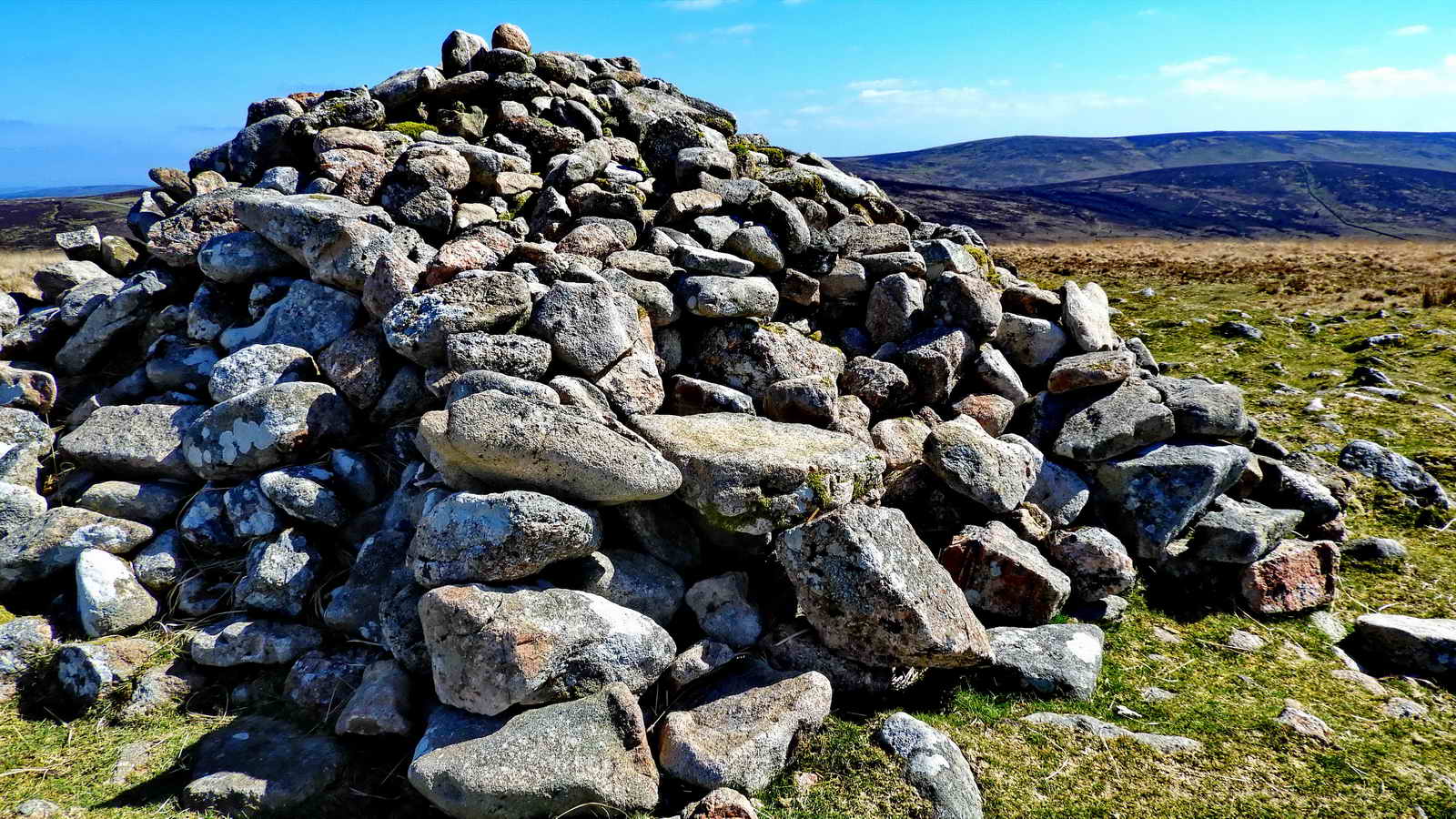
Water Hill Cairn
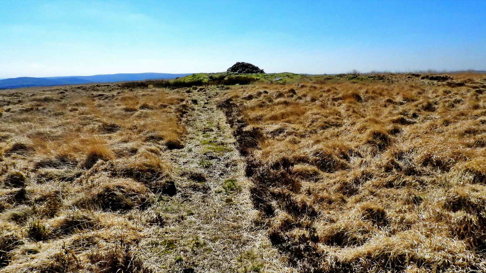
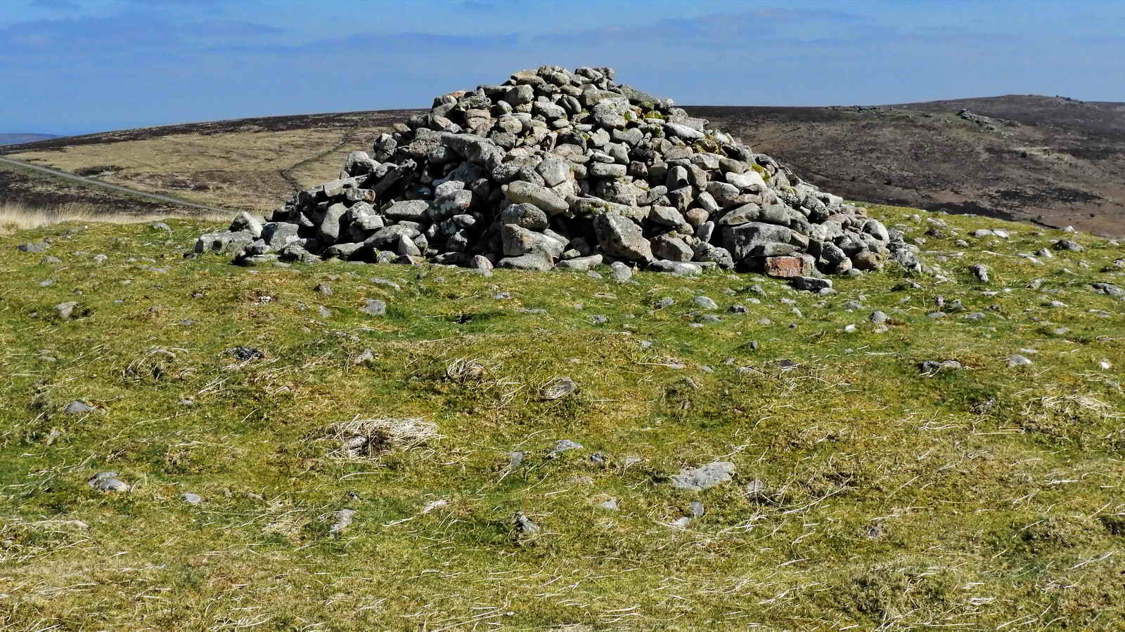
It is assumed that this landmark cairn, which is visible for some distance, is the “Furnum Regis” mentioned in the 1240 Perambulation of Dartmoor. This was occasioned by order of King Henry III when he granted the lands of the Forest of Dartmoor to his brother Richard. It was decreed that the Sheriff of Devon should do this accompanied by twelve knights and their attendants. Richard became an Earl in 1225 and was known as Richard of Cornwall (died 1272, aged 63)
- During World War II, this cairn was covered with a temporary iron roof and used as a lookout for enemy aircraft and a potential invasion forces.
- It has been known as Natty’s or Nancy’s Castle, although who this was seems to be lost.
This is the flat stone where King Arthur used to sit, looking west, contemplating the lands of Richard of Cornwall
This is a good vantage point to view the Ace Fields to the Southeast on the lower slopes of Birch Tor.
Legend records that there are four fields, each one shaped for the suites of a pack of cards. A young tin mining wastrel, name of Jan Reynolds, dared to play cards during a church sermon. The Devil descended and bore Jan away on his large and fierce black horse, never to be seen again. As he was borne away, Jan dropped his cards, forming these enclosures. (Full story at the link below)
The less prosaic reality is that they were farming enclosures used to grow vegetables for the nearby mines.
The return to the road from Water Hill Cairn is now just a short stroll downhill to conclude our walk
Parking
There is on-road parking close to the Warren House Inn, and several parking close to the start.
References
- Warren House History
- Heritage Gateway MDV18822 - Warren House Inn
- Dartefacts Telegraph Markers Map
- Heritage Gateway MDV27841 - Tin Working on South Side of Water Hill
- Heritage Gateway MDV54593 - Vast open cut on Water Hill
- Mindat mining and mineralogy details of this area
- Heritage Gateway MDV6620 - Cairn and cist at King’s Oven to the east of Water Hill
- Heritage Gateway MDV46484 - Millstone at King’s Oven Pound
- Heritage Gateway MDV61939 - Cairn at southern end of Stone Alignment on Hurston Ridge
- Legendary Dartmoor - Hurston Stone Row
- Heritage Gateway MDV6541- Hurston Ridge stone row
- Heritage Gateway MDV54619 - One of two cairns on the summit of Water Hill 450 metres north-west of Warren House Inn
- Legendary Dartmoor - Jan Reynolds